Eha Amufu night lights from space
Night Light of Eha Amufu (Enugu) from space (Nigeria) Src. Average luminocity for 10x10km area is 0% and for 50x50km: 1.0517%.
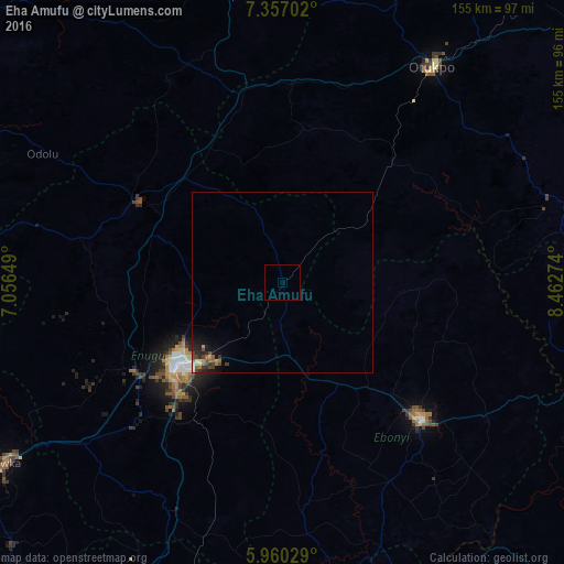
Analysis of Eha Amufu night lights 2016
Square area 10x10 km:
 0%
0%90-99
0%80-89
0%70-79
0%60-69
0%50-59
0%40-49
0%30-39
0%20-29
0%10-19
0%0-9
100%Square area 50x50 km:
0%90-99
0.13%80-89
0.11%70-79
0.14%60-69
0.19%50-59
0.16%40-49
0.38%30-39
0.24%20-29
0.37%10-19
0.67%0-9
97.6%Clear (daylight) street map image can be seen on geolist.org.
Map coordinates:
7° 21' 25.3" North, 7° 3' 23.4" East
6° 39' 32.9" North, 7° 45' 34.6" East
5° 57' 37" North, 8° 27' 45.9" East
Some cities around Eha Amufu sort by population:
• Enugu
37.6 km =23.4 mi,  229°
229°
• Isieke
43.5 km =27 mi,  135°
135°
• Effium
33.1 km =20.6 mi,  95°
95°
• Ezza-Ohu
43.3 km =26.9 mi,  124°
124°
• Opi
38.6 km =24 mi,  290°
290°
• Amagunze
38.4 km =23.9 mi,  197°
197°
• Ikem
14.3 km =8.9 mi,  339°
339°
• Obolo-Eke (1)
28.6 km =17.8 mi,  330°
330°
2343822 (p: 70,779)
Sources (retrieved 2019-11-25):
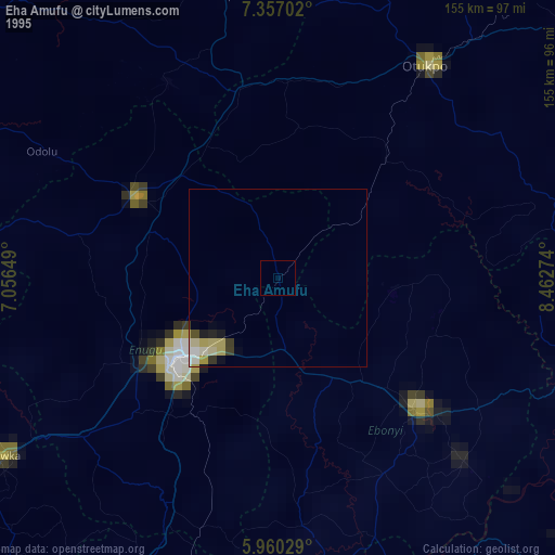
» NASA, Earths city lights 1995
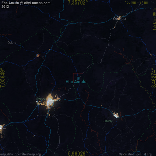
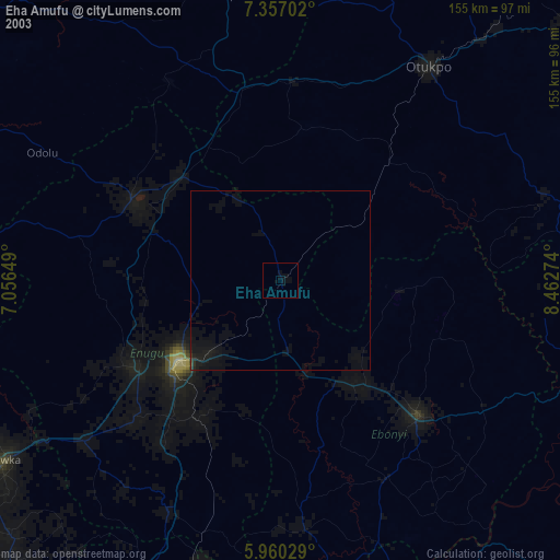
» NASA city lights 2003
» Earth at Night: Flat Maps 2012, 2016