Ondangwa night lights from space
Night Light of Ondangwa (Oshana) from space (Namibia) Src. Average luminocity for 10x10km area is 24.119% and for 50x50km: 2.8047%.
Analysis of Ondangwa night lights 2016
Square area 10x10 km:
 3.46%
3.46%90-99
2.38%80-89
5.63%70-79
3.25%60-69
2.6%50-59
0%40-49
0.65%30-39
8.87%20-29
3.9%10-19
24.24%0-9
45.02%Square area 50x50 km:
0.27%90-99
0.3%80-89
0.54%70-79
0.23%60-69
0.23%50-59
0.03%40-49
0.15%30-39
0.88%20-29
0.86%10-19
3.12%0-9
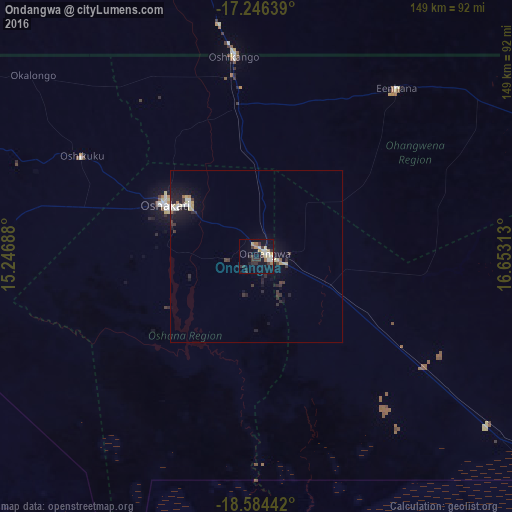
93.39%Clear (daylight) street map image can be seen on geolist.org.
Map coordinates:
17° 14' 47" South, 15° 14' 48.8" East
17° 55' 0" South, 15° 57' 0" East
18° 35' 3.9" South, 16° 39' 11.3" East
Some cities around Ondangwa sort by population:
• Oshakati
29.7 km =18.5 mi,  298°
298°
• Ondjiva, AO
97.3 km =60.5 mi,  346°
346°
• Ongwediva
24.4 km =15.2 mi,  307°
307°
• Okahao
93.5 km =58.1 mi,  271°
271°
• Opuwo
223.7 km =139 mi, 265°
• Omuthiya
83.3 km =51.8 mi,  126°
126°
• Outapi
112.4 km =69.8 mi,  294°
294°
• Eenhana
64.4 km =40 mi,  39°
39°
3354247 (p: 9,124)
Sources (retrieved 2019-11-25):
» Earth at Night: Flat Maps 2012, 2016