Taiping night lights from space
Night Light of Taiping (Perak) from space (Malaysia) Src. Average luminocity for 10x10km area is 71.8802% and for 50x50km: 10.4827%.
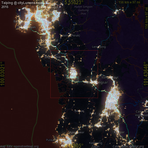
Analysis of Taiping night lights 2016
Square area 10x10 km:
 27.48%
90-99
24.59%80-89
5.99%70-79
3.51%60-69
3.51%50-59
3.72%40-49
4.75%30-39
2.07%20-29
16.94%10-19
7.44%0-9
0%Square area 50x50 km:
1.72%90-99
1.94%80-89
0.79%70-79
0.84%60-69
1.28%50-59
1.3%40-49
1.52%30-39
1.12%20-29
2.89%10-19
8.04%0-9
78.56%Clear (daylight) street map image can be seen on geolist.org.
Map coordinates:
5° 33' 0.8" North, 100° 1' 48.8" East
4° 51' 0" North, 100° 43' 60" East
4° 8' 56.6" North, 101° 26' 11.3" East
Some cities around Taiping sort by population:
• Ipoh
48.7 km =30.3 mi,  127°
127°
• Simpang Empat
15.7 km =9.8 mi,  315°
315°
• Batu Gajah
54.4 km =33.8 mi,  141°
141°
• Nibong Tebal
45.1 km =28 mi, 321°
• Kuala Kangsar
24 km =14.9 mi,  112°
112°
• Parit Buntar
40.7 km =25.3 mi, 319°
• Bagan Serai
27.8 km =17.3 mi,  310°
310°
• Pantai Remis
45.3 km =28.1 mi,  194°
194°
1734586 (p: 217,647)
Sources (retrieved 2019-11-25):
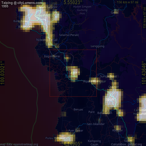
» NASA, Earths city lights 1995
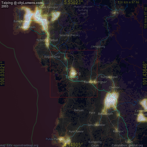
» NASA city lights 2003
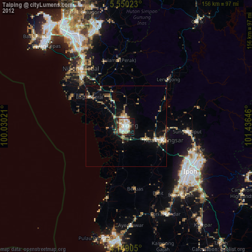
» Earth at Night: Flat Maps 2012, 2016