Nibong Tebal night lights from space
Night Light of Nibong Tebal (Penang) from space (Malaysia) Src. Average luminocity for 10x10km area is 64.1446% and for 50x50km: 24.7048%.
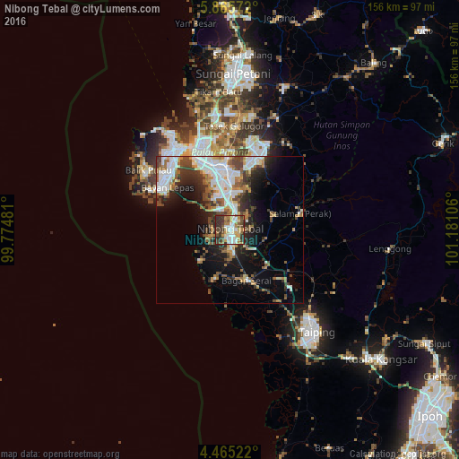
Analysis of Nibong Tebal night lights 2016
Square area 10x10 km:
 14.46%
90-99
12.6%80-89
6.61%70-79
11.78%60-69
9.92%50-59
7.85%40-49
8.06%30-39
18.18%20-29
10.54%10-19
0%0-9
0%Square area 50x50 km:
6.12%90-99
4.79%80-89
1.63%70-79
2.69%60-69
3.16%50-59
3.23%40-49
3.73%30-39
3.85%20-29
5.31%10-19
9.16%0-9
56.33%Clear (daylight) street map image can be seen on geolist.org.
Map coordinates:
5° 51' 56.6" North, 99° 46' 29.3" East
5° 9' 57.1" North, 100° 28' 40.5" East
4° 27' 54.8" North, 101° 10' 51.8" East
Some cities around Nibong Tebal sort by population:
• Bukit Mertajam
22 km =13.7 mi,  356°
356°
• Kulim
24 km =14.9 mi,  22°
22°
• Kampung Sungai Ara
28.9 km =18 mi,  308°
308°
• Butterworth
28.8 km =17.9 mi,  334°
334°
• Perai
26.4 km =16.4 mi,  336°
336°
• Parit Buntar
4.7 km =2.9 mi,  158°
158°
• Bagan Serai
18.6 km =11.6 mi, 157°
• Juru
16.7 km =10.4 mi,  346°
346°
1735086 (p: 40,072)
Sources (retrieved 2019-11-25):
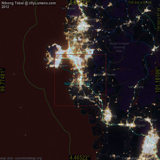
» Earth at Night: Flat Maps 2012, 2016