Kampar night lights from space
Night Light of Kampar (Perak) from space (Malaysia) Src. Average luminocity for 10x10km area is 36.2532% and for 50x50km: 14.8992%.
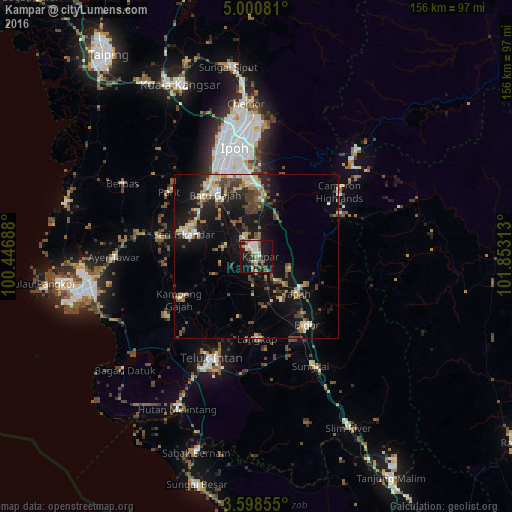
Analysis of Kampar night lights 2016
Square area 10x10 km:
 6.49%
6.49%90-99
6.28%80-89
2.6%70-79
3.9%60-69
3.9%50-59
6.71%40-49
8.44%30-39
1.3%20-29
4.11%10-19
47.84%0-9
8.44%Square area 50x50 km:
1.39%90-99
1.95%80-89
1.53%70-79
1.54%60-69
1.97%50-59
2.4%40-49
3.38%30-39
2.6%20-29
2.68%10-19
15.27%0-9
65.28%Clear (daylight) street map image can be seen on geolist.org.
Map coordinates:
5° 0' 2.9" North, 100° 26' 48.8" East
4° 18' 0" North, 101° 9' 0" East
3° 35' 54.8" North, 101° 51' 11.3" East
Some cities around Kampar sort by population:
• Ipoh
32.5 km =20.2 mi,  346°
346°
• Teluk Intan
34 km =21.1 mi,  204°
204°
• Batu Gajah
22.4 km =13.9 mi,  327°
327°
• Lumut
58.2 km =36.2 mi,  262°
262°
• Kuala Kangsar
57.2 km =35.5 mi,  335°
335°
• Bidur
25.2 km =15.7 mi,  144°
144°
• Tapah Road
15.8 km =9.8 mi,  159°
159°
• Tanah Rata
31 km =19.3 mi,  54°
54°
1735274 (p: 19,056)
Sources (retrieved 2019-11-25):
» Earth at Night: Flat Maps 2012, 2016