Zacualtipán night lights from space
Night Light of Zacualtipán (Hidalgo) from space (Mexico) Src. Average luminocity for 10x10km area is 13.072% and for 50x50km: 1.337%.
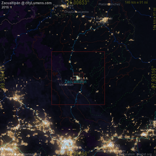
Analysis of Zacualtipán night lights 2016
Square area 10x10 km:
 0.19%
0.19%90-99
1.89%80-89
1.89%70-79
2.84%60-69
0.76%50-59
2.08%40-49
1.14%30-39
4.36%20-29
1.89%10-19
1.52%0-9
81.44%Square area 50x50 km:
0.01%90-99
0.1%80-89
0.21%70-79
0.2%60-69
0.16%50-59
0.2%40-49
0.25%30-39
0.57%20-29
0.43%10-19
0.14%0-9
97.73%Clear (daylight) street map image can be seen on geolist.org.
Map coordinates:
21° 18' 23.5" North, 99° 21' 33.9" West
20° 39' 0.1" North, 98° 39' 22.6" West
19° 59' 26.4" North, 97° 57' 11.4" West
Some cities around Zacualtipán sort by population:
• Huejutla de Reyes
59.8 km =37.2 mi,  24°
24°
• Actopan
51.8 km =32.2 mi,  215°
215°
• Mineral del Monte
56.9 km =35.4 mi,  181°
181°
• Atotonilco el Grande
40.5 km =25.2 mi, 181°
• San Felipe Orizatlán
58.2 km =36.2 mi,  5°
5°
• Jaltocan
55.1 km =34.2 mi, 12°
• Huayacocotla
22.2 km =13.8 mi,  124°
124°
• Tlanchinol
38 km =23.6 mi,  359°
359°
3514134 (p: 23,125)
Sources (retrieved 2019-11-25):
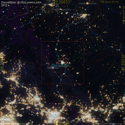
» Earth at Night: Flat Maps 2012, 2016