San Felipe Orizatlán night lights from space
Night Light of San Felipe Orizatlán (Hidalgo) from space (Mexico) Src. Average luminocity for 10x10km area is 4.502% and for 50x50km: 4.0904%.
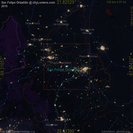
Analysis of San Felipe Orizatlán night lights 2016
Square area 10x10 km:
 0%
0%90-99
0.2%80-89
0.6%70-79
0.2%60-69
1.98%50-59
0.2%40-49
1.59%30-39
0.6%20-29
0.6%10-19
0.4%0-9
93.65%Square area 50x50 km:
0%90-99
0.07%80-89
0.42%70-79
0.54%60-69
0.98%50-59
0.57%40-49
1.39%30-39
1.19%20-29
0.98%10-19
1.59%0-9
92.27%Clear (daylight) street map image can be seen on geolist.org.
Map coordinates:
21° 49' 31" North, 99° 18' 38.1" West
21° 10' 15.9" North, 98° 36' 26.8" West
20° 30' 50.3" North, 97° 54' 15.6" West
Some cities around San Felipe Orizatlán sort by population:
• Huejutla de Reyes
19.8 km =12.3 mi,  100°
100°
• Tantoyuca
44.3 km =27.5 mi,  63°
63°
• Tamazunchale
21.3 km =13.2 mi,  297°
297°
• Tempoal de Sánchez
44.9 km =27.9 mi,  30°
30°
• Platón Sánchez
26.6 km =16.5 mi,  65°
65°
• Axtla de Terrazas
40.7 km =25.3 mi,  317°
317°
• Jaltocan
8.3 km =5.2 mi,  120°
120°
• Tlanchinol
20.6 km =12.8 mi,  194°
194°
3522302 (p: 6,686)
Sources (retrieved 2019-11-25):
» Earth at Night: Flat Maps 2012, 2016