Jaltocan night lights from space
Night Light of Jaltocan (Hidalgo) from space (Mexico) Src. Average luminocity for 10x10km area is 8.1329% and for 50x50km: 3.4277%.
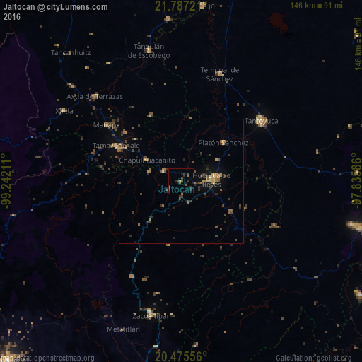
Analysis of Jaltocan night lights 2016
Square area 10x10 km:
 0%
0%90-99
0%80-89
0.79%70-79
0%60-69
1.39%50-59
0.99%40-49
3.17%30-39
3.97%20-29
3.97%10-19
2.38%0-9
83.33%Square area 50x50 km:
0%90-99
0.06%80-89
0.28%70-79
0.45%60-69
0.93%50-59
0.44%40-49
1.06%30-39
1%20-29
0.97%10-19
1.41%0-9
93.4%Clear (daylight) street map image can be seen on geolist.org.
Map coordinates:
21° 47' 14" North, 99° 14' 31.6" West
21° 7' 58.2" North, 98° 32' 20.3" West
20° 28' 32" North, 97° 50' 9.1" West
Some cities around Jaltocan sort by population:
• Huejutla de Reyes
12.4 km =7.7 mi,  86°
86°
• Tantoyuca
40.5 km =25.2 mi,  53°
53°
• Tamazunchale
29.6 km =18.4 mi,  298°
298°
• Tempoal de Sánchez
45.8 km =28.5 mi,  19°
19°
• Platón Sánchez
23 km =14.3 mi, 47°
• Axtla de Terrazas
48.7 km =30.3 mi,  314°
314°
• San Felipe Orizatlán
8.3 km =5.2 mi, 300°
• Tlanchinol
19.9 km =12.4 mi,  218°
218°
3526591 (p: 6,201)
Sources (retrieved 2019-11-25):
» Earth at Night: Flat Maps 2012, 2016