Zacoalco de Torres night lights from space
Night Light of Zacoalco de Torres (Jalisco) from space (Mexico) Src. Average luminocity for 10x10km area is 10.125% and for 50x50km: 6.5567%.
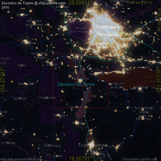
Analysis of Zacoalco de Torres night lights 2016
Square area 10x10 km:
 0%
0%90-99
0.4%80-89
2.78%70-79
3.37%60-69
2.18%50-59
0%40-49
0%30-39
0.79%20-29
2.18%10-19
1.19%0-9
87.1%Square area 50x50 km:
0.05%90-99
0.32%80-89
1.28%70-79
1.19%60-69
1.26%50-59
0.59%40-49
1.23%30-39
1.15%20-29
1.72%10-19
3.6%0-9
87.61%Clear (daylight) street map image can be seen on geolist.org.
Map coordinates:
20° 53' 11.4" North, 104° 16' 18.6" West
20° 13' 41.4" North, 103° 34' 7.3" West
19° 34' 1.2" North, 102° 51' 56.1" West
Some cities around Zacoalco de Torres sort by population:
• Jocotepec
15.9 km =9.9 mi,  66°
66°
• Acatlán de Juárez
21.7 km =13.5 mi,  353°
353°
• Villa Corona
23.1 km =14.4 mi,  334°
334°
• San Miguel Cuyutlán
28 km =17.4 mi,  41°
41°
• Bellavista
24 km =14.9 mi,  342°
342°
• San Juan Cosalá
24.6 km =15.3 mi, 74°
• Atemajac de Brizuela
19.3 km =12 mi,  238°
238°
• Atoyac
24.9 km =15.5 mi,  167°
167°
3979822 (p: 18,172)
Sources (retrieved 2019-11-25):
» Earth at Night: Flat Maps 2012, 2016