Jocotepec night lights from space
Night Light of Jocotepec (Jalisco) from space (Mexico) Src. Average luminocity for 10x10km area is 16.3313% and for 50x50km: 16.1882%.
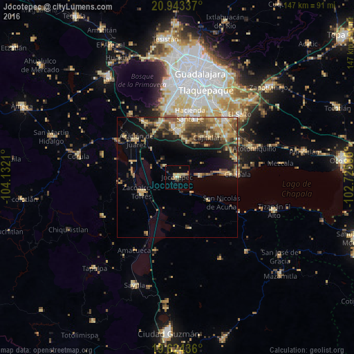
Analysis of Jocotepec night lights 2016
Square area 10x10 km:
 0%
0%90-99
1.79%80-89
4.37%70-79
2.18%60-69
3.97%50-59
0%40-49
2.38%30-39
2.98%20-29
1.59%10-19
1.59%0-9
79.17%Square area 50x50 km:
0.97%90-99
1.42%80-89
3.48%70-79
3.33%60-69
2.74%50-59
2.42%40-49
2.95%30-39
2.62%20-29
3.2%10-19
6.89%0-9
69.98%Clear (daylight) street map image can be seen on geolist.org.
Map coordinates:
20° 56' 36.1" North, 104° 7' 55.6" West
20° 17' 7" North, 103° 25' 44.3" West
19° 37' 27.7" North, 102° 43' 33.1" West
Some cities around Jocotepec sort by population:
• Tlajomulco de Zúñiga
21.1 km =13.1 mi,  355°
355°
• Zacoalco de Torres
15.9 km =9.9 mi,  246°
246°
• Ajijic
18.3 km =11.4 mi,  83°
83°
• Acatlán de Juárez
22.7 km =14.1 mi,  312°
312°
• San Miguel Cuyutlán
15.1 km =9.4 mi,  15°
15°
• San Juan Cosalá
9.2 km =5.7 mi,  88°
88°
• Galaxia la Noria
19.1 km =11.9 mi,  3°
3°
• Cajititlán
20.5 km =12.7 mi,  37°
37°
4003908 (p: 18,852)
Sources (retrieved 2019-11-25):
» Earth at Night: Flat Maps 2012, 2016