Tlaxco night lights from space
Night Light of Tlaxco (Tlaxcala) from space (Mexico) Src. Average luminocity for 10x10km area is 22.0744% and for 50x50km: 11.5369%.
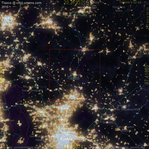
Analysis of Tlaxco night lights 2016
Square area 10x10 km:
 0.41%
0.41%90-99
1.45%80-89
2.89%70-79
2.07%60-69
6.61%50-59
4.13%40-49
3.31%30-39
5.17%20-29
3.93%10-19
15.7%0-9
54.34%Square area 50x50 km:
0.51%90-99
0.82%80-89
2.47%70-79
1.92%60-69
2.19%50-59
1.19%40-49
2.35%30-39
2.08%20-29
2.63%10-19
5.97%0-9
77.87%Clear (daylight) street map image can be seen on geolist.org.
Map coordinates:
20° 16' 31.3" North, 98° 49' 23.2" West
19° 36' 51.9" North, 98° 7' 11.9" West
18° 57' 2.7" North, 97° 25' 0.7" West
Some cities around Tlaxco sort by population:
• Apizaco
22.5 km =14 mi,  186°
186°
• Tetla
19.2 km =11.9 mi,  174°
174°
• Xaloztoc
24.3 km =15.1 mi,  161°
161°
• Zimatepec
22 km =13.7 mi, 192°
• Santa María Texcalac
21.5 km =13.4 mi, 170°
• San Luis Apizaquito
21 km =13 mi,  179°
179°
• San José Tetel
20.6 km =12.8 mi, 191°
• San Benito Xaltocan
23.7 km =14.7 mi, 191°
3515349 (p: 14,806)
Sources (retrieved 2019-11-25):
» Earth at Night: Flat Maps 2012, 2016