San Luis Apizaquito night lights from space
Night Light of San Luis Apizaquito (Tlaxcala) from space (Mexico) Src. Average luminocity for 10x10km area is 77.1033% and for 50x50km: 28.6384%.
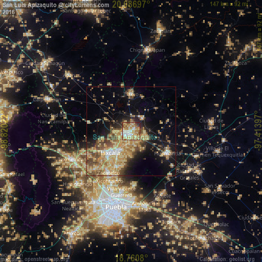
Analysis of San Luis Apizaquito night lights 2016
Square area 10x10 km:
 10.54%
90-99
15.7%80-89
22.31%70-79
16.32%60-69
22.52%50-59
4.96%40-49
3.31%30-39
1.86%20-29
2.48%10-19
0%0-9
0%Square area 50x50 km:
1.58%90-99
2.56%80-89
8.1%70-79
6.21%60-69
5.38%50-59
3.67%40-49
5.58%30-39
3.34%20-29
4.2%10-19
11.65%0-9
47.73%Clear (daylight) street map image can be seen on geolist.org.
Map coordinates:
20° 5' 13.1" North, 98° 49' 12.8" West
19° 25' 30.9" North, 98° 7' 1.5" West
18° 45' 38.9" North, 97° 24' 50.3" West
Some cities around San Luis Apizaquito sort by population:
• Apizaco
3.1 km =1.9 mi,  244°
244°
• Tetla
2.4 km =1.5 mi,  37°
37°
• San Andrés Ahuashuatepec
5.3 km =3.3 mi,  168°
168°
• Zimatepec
5 km =3.1 mi,  264°
264°
• Santa Anita Huiloac
5 km =3.1 mi,  214°
214°
• Santa María Texcalac
3.2 km =2 mi,  93°
93°
• San José Tetel
4.5 km =2.8 mi,  281°
281°
• San Benito Xaltocan
5.6 km =3.5 mi,  247°
247°
3815194 (p: 6,099)
Sources (retrieved 2019-11-25):
» Earth at Night: Flat Maps 2012, 2016