Apizaco night lights from space
Night Light of Apizaco (Tlaxcala) from space (Mexico) Src. Average luminocity for 10x10km area is 77.6715% and for 50x50km: 30.2013%.
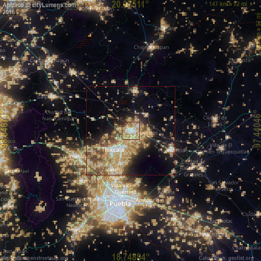

Analysis of Apizaco night lights 2016
Square area 10x10 km:
 11.57%
90-99
15.91%80-89
19.01%70-79
26.24%60-69
17.36%50-59
1.65%40-49
2.89%30-39
2.07%20-29
3.31%10-19
0%0-9
0%Square area 50x50 km:
1.61%90-99
2.67%80-89
8.71%70-79
6.5%60-69
5.65%50-59
4.29%40-49
6.13%30-39
3.48%20-29
4.36%10-19
11%0-9
45.61%Clear (daylight) street map image can be seen on geolist.org.
Map coordinates:
20° 4' 30.4" North, 98° 50' 48.2" West
19° 24' 48" North, 98° 8' 36.9" West
18° 44' 55.8" North, 97° 26' 25.7" West
Some cities around Apizaco sort by population:
• Tetla
5.3 km =3.3 mi,  52°
52°
• San Andrés Ahuashuatepec
5.5 km =3.4 mi,  135°
135°
• Zimatepec
2.4 km =1.5 mi,  291°
291°
• Santa Anita Huiloac
2.8 km =1.7 mi,  180°
180°
• San Luis Apizaquito
3.1 km =1.9 mi,  64°
64°
• San José Tetel
2.8 km =1.7 mi,  322°
322°
• San Miguel Contla
5.9 km =3.7 mi,  168°
168°
• San Benito Xaltocan
2.6 km =1.6 mi,  251°
251°
3532792 (p: 49,506)
Sources (retrieved 2019-11-25):
» NASA, Earths city lights 1995
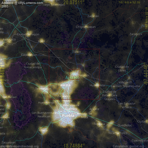
» NASA city lights 2003
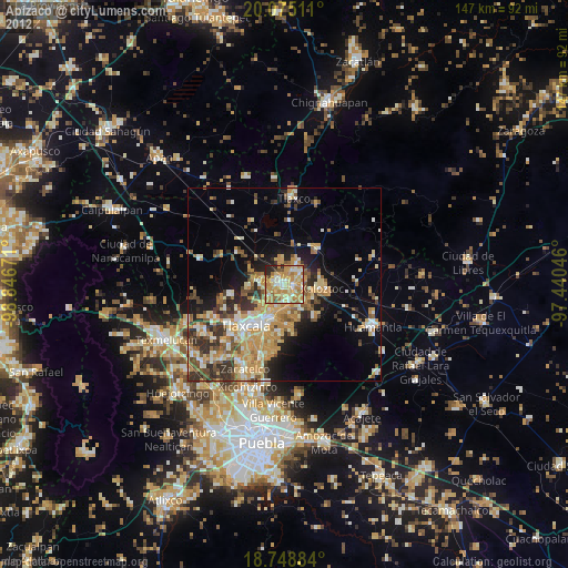
» Earth at Night: Flat Maps 2012, 2016