Ticul night lights from space
Night Light of Ticul (Yucatán) from space (Mexico) Src. Average luminocity for 10x10km area is 20.8239% and for 50x50km: 3.8193%.
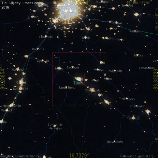
Analysis of Ticul night lights 2016
Square area 10x10 km:
100  0.38%
0.38%
90-99 2.65%
80-89 8.33%
70-79 1.89%
60-69 1.14%
50-59 1.52%
40-49 2.65%
30-39 1.89%
20-29 1.89%
10-19 15.72%
0-9 61.93%
0.38%90-99
2.65%80-89
8.33%70-79
1.89%60-69
1.14%50-59
1.52%40-49
2.65%30-39
1.89%20-29
1.89%10-19
15.72%0-9
61.93%Square area 50x50 km:
100 0.02%
90-99 0.52%
80-89 1.1%
70-79 0.39%
60-69 0.32%
50-59 0.41%
40-49 0.72%
30-39 0.54%
20-29 0.45%
10-19 1.19%
0-9 94.35%
0.02%90-99
0.52%80-89
1.1%70-79
0.39%60-69
0.32%50-59
0.41%40-49
0.72%30-39
0.54%20-29
0.45%10-19
1.19%0-9
94.35%Clear (daylight) street map image can be seen on geolist.org.
Map coordinates:
21° 3' 21.4" North, 90° 14' 18.7" West
20° 23' 54" North, 89° 32' 7.5" West
19° 44' 16.4" North, 88° 49' 56.2" West
Some cities around Ticul sort by population:
• Tecax
33.8 km =21 mi,  129°
129°
• Oxkutzkab
15.9 km =9.9 mi, 129°
• Muna
21.1 km =13.1 mi,  298°
298°
• Akil
24.5 km =15.2 mi, 127°
• Tekit
26 km =16.2 mi,  54°
54°
• Tekoh
38.9 km =24.2 mi,  9°
9°
• Homun
46 km =28.6 mi,  34°
34°
• Teabo
26.3 km =16.3 mi,  89°
89°
3515665 (p: 32,796)
Sources (retrieved 2019-11-25):
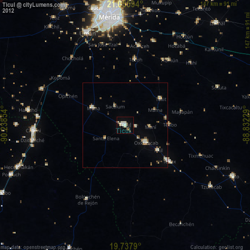
» Earth at Night: Flat Maps 2012, 2016