Akil night lights from space
Night Light of Akil (Yucatán) from space (Mexico) Src. Average luminocity for 10x10km area is 9.5774% and for 50x50km: 3.8334%.
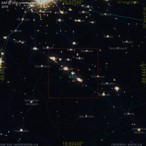
Analysis of Akil night lights 2016
Square area 10x10 km:
100  0%
0%
90-99 0.4%
80-89 1.98%
70-79 1.59%
60-69 0%
50-59 0.79%
40-49 2.58%
30-39 1.98%
20-29 1.19%
10-19 1.39%
0-9 88.1%
0%90-99
0.4%80-89
1.98%70-79
1.59%60-69
0%50-59
0.79%40-49
2.58%30-39
1.98%20-29
1.19%10-19
1.39%0-9
88.1%Square area 50x50 km:
100 0.06%
90-99 0.58%
80-89 1%
70-79 0.4%
60-69 0.29%
50-59 0.36%
40-49 0.72%
30-39 0.51%
20-29 0.47%
10-19 1.44%
0-9 94.17%
0.06%90-99
0.58%80-89
1%70-79
0.4%60-69
0.29%50-59
0.36%40-49
0.72%30-39
0.51%20-29
0.47%10-19
1.44%0-9
94.17%Clear (daylight) street map image can be seen on geolist.org.
Map coordinates:
20° 55' 25.2" North, 90° 3' 3.6" West
20° 15' 55.7" North, 89° 20' 52.3" West
19° 36' 16.1" North, 88° 38' 41.1" West
Some cities around Akil sort by population:
• Ticul
24.5 km =15.2 mi,  307°
307°
• Tecax
9.4 km =5.8 mi,  135°
135°
• Oxkutzkab
8.7 km =5.4 mi,  302°
302°
• Peto
46.9 km =29.1 mi,  109°
109°
• Muna
45.5 km =28.3 mi, 302°
• Tzucacab
37.8 km =23.5 mi,  124°
124°
• Tekit
30 km =18.6 mi,  2°
2°
• Teabo
16.5 km =10.3 mi,  24°
24°
3533117 (p: 10,176)
Sources (retrieved 2019-11-25):
» Earth at Night: Flat Maps 2012, 2016