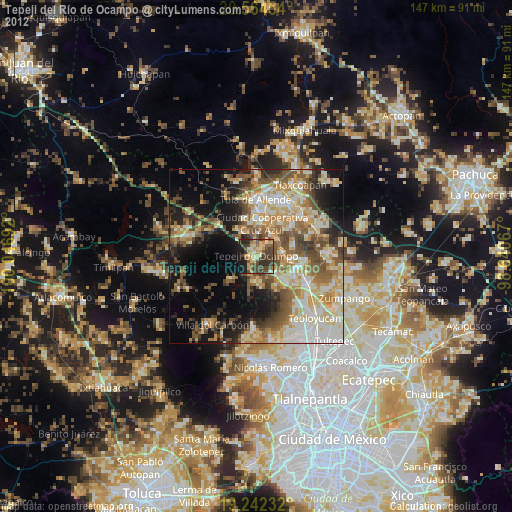
Tepeji del Río de Ocampo night lights from space
Night Light of Tepeji del Río de Ocampo (Hidalgo) from space (Mexico) Src. Average luminocity for 10x10km area is 40.21% and for 50x50km: 34.6477%.
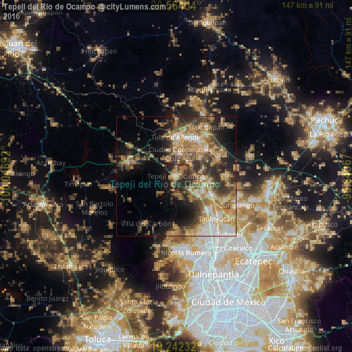
Analysis of Tepeji del Río de Ocampo night lights 2016
Square area 10x10 km:
 0.43%
0.43%90-99
0.43%80-89
4.11%70-79
8.44%60-69
15.15%50-59
5.63%40-49
9.31%30-39
11.26%20-29
24.24%10-19
20.35%0-9
0.65%Square area 50x50 km:
3.16%90-99
4.01%80-89
4.89%70-79
6.86%60-69
9.01%50-59
5.39%40-49
6.44%30-39
6.68%20-29
8.32%10-19
10.79%0-9
34.45%Clear (daylight) street map image can be seen on geolist.org.
Map coordinates:
20° 33' 52.3" North, 100° 2' 48.9" West
19° 54' 17.3" North, 99° 20' 37.6" West
19° 14' 32.4" North, 98° 38' 26.4" West
Some cities around Tepeji del Río de Ocampo sort by population:
• Santa Teresa
13.3 km =8.3 mi,  119°
119°
• Tula de Allende
16.3 km =10.1 mi,  359°
359°
• San Marcos
14 km =8.7 mi,  3°
3°
• Huehuetoca
16.9 km =10.5 mi, 120°
• Atotonilco de Tula
17.4 km =10.8 mi,  48°
48°
• San Miguel Vindho
10.3 km =6.4 mi,  15°
15°
• San Bartolo
17.7 km =11 mi, 116°
• Salitrillo
15.8 km =9.8 mi, 122°
3515887 (p: 34,151)
Sources (retrieved 2019-11-25):
» Earth at Night: Flat Maps 2012, 2016