Tecate night lights from space
Night Light of Tecate (Baja California) from space (Mexico) Src. Average luminocity for 10x10km area is 34.8689% and for 50x50km: 9.2307%.
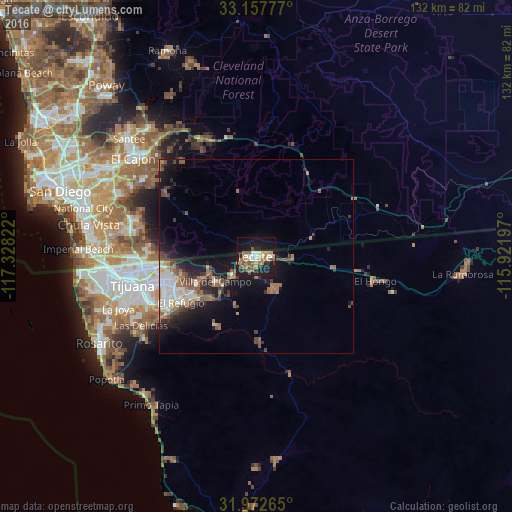

Analysis of Tecate night lights 2016
Square area 10x10 km:
 4.37%
4.37%90-99
3.32%80-89
3.32%70-79
5.24%60-69
7.87%50-59
6.82%40-49
6.47%30-39
2.45%20-29
5.07%10-19
39.69%0-9
15.38%Square area 50x50 km:
1.16%90-99
1.53%80-89
0.51%70-79
0.61%60-69
2.09%50-59
1.69%40-49
1.63%30-39
1.36%20-29
2.21%10-19
7.26%0-9
79.94%Clear (daylight) street map image can be seen on geolist.org.
Map coordinates:
33° 9' 28" North, 117° 19' 41.6" West
32° 34' 1.8" North, 116° 37' 30.3" West
31° 58' 21.5" North, 115° 55' 19.1" West
Some cities around Tecate sort by population:
• Terrazas del Valle
20.9 km =13 mi,  244°
244°
• Alpine, US
32.6 km =20.3 mi,  336°
336°
• Villa del Campo
12.5 km =7.8 mi, 237°
• El Niño
17 km =10.6 mi,  247°
247°
• San Luis
34.3 km =21.3 mi, 243°
• Maclovio Rojas
19.7 km =12.2 mi, 237°
• Lomas de Santa Anita
3.7 km =2.3 mi,  222°
222°
• Jamul, US
28.8 km =17.9 mi,  305°
305°
3982266 (p: 64,764)
Sources (retrieved 2019-11-25):
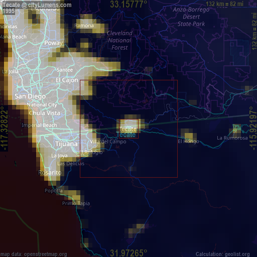
» NASA, Earths city lights 1995
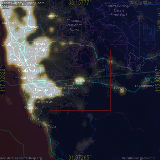
» NASA city lights 2003
» Earth at Night: Flat Maps 2012, 2016