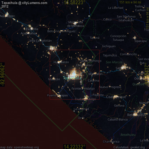
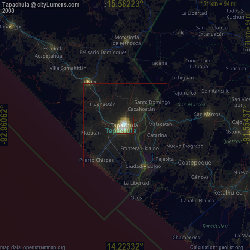
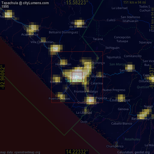
Tapachula night lights from space
Night Light of Tapachula (Chiapas) from space (Mexico) Src. Average luminocity for 10x10km area is 68.5186% and for 50x50km: 9.4959%.
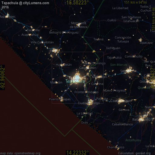
Analysis of Tapachula night lights 2016
Square area 10x10 km:
 14.46%
90-99
21.49%80-89
12.19%70-79
9.09%60-69
8.06%50-59
2.48%40-49
8.26%30-39
6.82%20-29
12.19%10-19
4.96%0-9
0%Square area 50x50 km:
0.6%90-99
1.32%80-89
1.17%70-79
1.08%60-69
1.24%50-59
1.08%40-49
2.02%30-39
2.27%20-29
2.65%10-19
6.2%0-9
80.38%Clear (daylight) street map image can be seen on geolist.org.
Map coordinates:
15° 34' 56" North, 92° 57' 38.2" West
14° 54' 13.9" North, 92° 15' 27" West
14° 13' 24" North, 91° 33' 15.7" West
Some cities around Tapachula sort by population:
• Cacahoatán
14.1 km =8.8 mi,  45°
45°
• Malacatán, GT
21.5 km =13.4 mi,  87°
87°
• Huehuetán
18.6 km =11.6 mi,  313°
313°
• Tuxtla Chico
10.5 km =6.5 mi,  67°
67°
• Mazatán
21.2 km =13.2 mi,  257°
257°
• Vida Mejor I
6.6 km =4.1 mi,  234°
234°
• Estación Huehuetán
20 km =12.4 mi, 306°
• Álvaro Obregón
13.1 km =8.1 mi,  278°
278°
3516266 (p: 202,672)
Sources (retrieved 2019-11-25):
» NASA, Earths city lights 1995
» NASA city lights 2003
» Earth at Night: Flat Maps 2012, 2016