Tampico night lights from space
Night Light of Tampico (Tamaulipas) from space (Mexico) Src. Average luminocity for 10x10km area is 78.0076% and for 50x50km: 15.3744%.
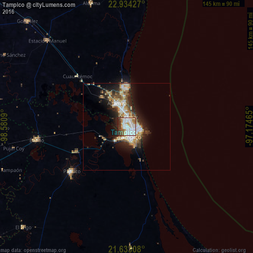
Analysis of Tampico night lights 2016
Square area 10x10 km:
 35.8%
35.8%90-99
20.08%80-89
5.68%70-79
4.55%60-69
7.39%50-59
3.98%40-49
6.25%30-39
7.01%20-29
9.28%10-19
0%0-9
0%Square area 50x50 km:
3.06%90-99
3.11%80-89
1.89%70-79
1.51%60-69
2.31%50-59
1.4%40-49
2.07%30-39
2.14%20-29
4.65%10-19
6.89%0-9
70.98%Clear (daylight) street map image can be seen on geolist.org.
Map coordinates:
22° 56' 3.4" North, 98° 34' 51.2" West
22° 17' 6.7" North, 97° 52' 40" West
21° 37' 59.1" North, 97° 10' 28.7" West
Some cities around Tampico sort by population:
• Ciudad Madero
4.5 km =2.8 mi,  108°
108°
• Miramar
8.7 km =5.4 mi,  344°
344°
• Altamira
13.4 km =8.3 mi,  332°
332°
• Benito Juárez
10.1 km =6.3 mi,  157°
157°
• Anahuac
9.5 km =5.9 mi,  165°
165°
• Moralillo
7.5 km =4.7 mi,  208°
208°
• Ciudad Cuauhtémoc
12.1 km =7.5 mi, 158°
• Primero de Mayo
9 km =5.6 mi,  137°
137°
3516355 (p: 309,003)
Sources (retrieved 2019-11-25):
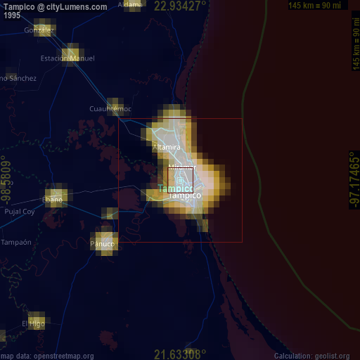
» NASA, Earths city lights 1995
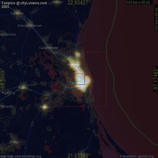
» NASA city lights 2003
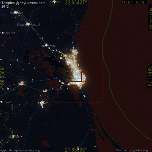
» Earth at Night: Flat Maps 2012, 2016