Santa María Huatulco night lights from space
Night Light of Santa María Huatulco (Oaxaca) from space (Mexico) Src. Average luminocity for 10x10km area is 7.9004% and for 50x50km: 2.2542%.
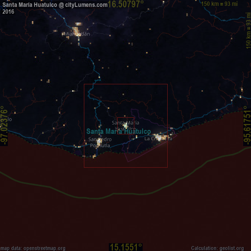
Analysis of Santa María Huatulco night lights 2016
Square area 10x10 km:
 0%
0%90-99
2.6%80-89
2.6%70-79
0.87%60-69
0%50-59
0%40-49
1.73%30-39
0.65%20-29
0.65%10-19
0.87%0-9
90.04%Square area 50x50 km:
0.12%90-99
0.43%80-89
0.4%70-79
0.32%60-69
0.11%50-59
0.15%40-49
0.57%30-39
0.23%20-29
0.33%10-19
0.97%0-9
96.37%Clear (daylight) street map image can be seen on geolist.org.
Map coordinates:
16° 30' 28.7" North, 97° 1' 25.5" West
15° 49' 57.6" North, 96° 19' 14.3" West
15° 9' 18.4" North, 95° 37' 3" West
Some cities around Santa María Huatulco sort by population:
• Puerto Escondido
81 km =50.3 mi,  272°
272°
• Miahuatlán de Porfirio Díaz
62.9 km =39.1 mi,  332°
332°
• Crucecita
21.1 km =13.1 mi,  109°
109°
• San Pedro Pochutla
18.3 km =11.4 mi,  238°
238°
• Brisas de Zicatela
77.2 km =48 mi, 270°
• Ejutla de Crespo
92.6 km =57.5 mi, 331°
• Bajos de Chila
86.2 km =53.6 mi,  276°
276°
• Santos Reyes Nopala
93.2 km =57.9 mi,  289°
289°
3517251 (p: 7,409)
Sources (retrieved 2019-11-25):
» Earth at Night: Flat Maps 2012, 2016