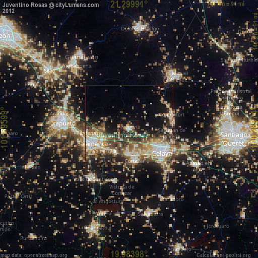
Juventino Rosas night lights from space
Night Light of Juventino Rosas (Guanajuato) from space (Mexico) Src. Average luminocity for 10x10km area is 33.8864% and for 50x50km: 30.1096%.
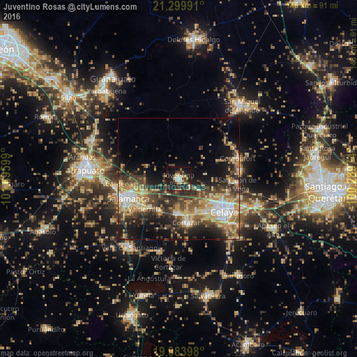
Analysis of Juventino Rosas night lights 2016
Square area 10x10 km:
 2.65%
2.65%90-99
2.84%80-89
7.2%70-79
4.92%60-69
1.52%50-59
2.46%40-49
8.52%30-39
9.47%20-29
17.05%10-19
32.95%0-9
10.42%Square area 50x50 km:
3.03%90-99
3.7%80-89
5.9%70-79
5.24%60-69
4.2%50-59
4.04%40-49
6.71%30-39
6.4%20-29
8%10-19
12.51%0-9
40.27%Clear (daylight) street map image can be seen on geolist.org.
Map coordinates:
21° 17' 59.7" North, 101° 41' 45.6" West
20° 38' 36.1" North, 100° 59' 34.3" West
19° 59' 2.3" North, 100° 17' 23.1" West
Some cities around Juventino Rosas sort by population:
• Salamanca
22.1 km =13.7 mi,  248°
248°
• Cortazar
18 km =11.2 mi,  169°
169°
• Villagrán
14.3 km =8.9 mi,  181°
181°
• Valtierrilla
18.7 km =11.6 mi,  228°
228°
• Santiago de Cuenda
4.9 km =3 mi, 181°
• Mexicanos
15.1 km =9.4 mi,  212°
212°
• Cerro Gordo
15 km =9.3 mi, 248°
• Sarabia
15.2 km =9.4 mi, 208°
4003662 (p: 42,264)
Sources (retrieved 2019-11-25):
» Earth at Night: Flat Maps 2012, 2016