San Martín Azcatepec night lights from space
Night Light of San Martín Azcatepec (México) from space (Mexico) Src. Average luminocity for 10x10km area is 82.7727% and for 50x50km: 69.1601%.
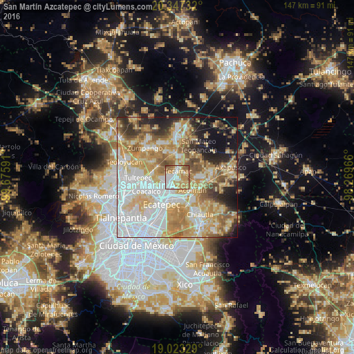
Analysis of San Martín Azcatepec night lights 2016
Square area 10x10 km:
 22.31%
90-99
17.98%80-89
17.15%70-79
21.28%60-69
11.57%50-59
8.26%40-49
1.45%30-39
0%20-29
0%10-19
0%0-9
0%Square area 50x50 km:
20.11%90-99
11.8%80-89
13.48%70-79
13%60-69
10.66%50-59
6.1%40-49
5.13%30-39
4%20-29
5.87%10-19
7.44%0-9
2.41%Clear (daylight) street map image can be seen on geolist.org.
Map coordinates:
20° 20' 50.4" North, 99° 40' 33.3" West
19° 41' 12" North, 98° 58' 22" West
19° 1' 23.8" North, 98° 16' 10.8" West
Some cities around San Martín Azcatepec sort by population:
• Ojo de Agua
4 km =2.5 mi,  259°
259°
• Tecámac de Felipe Villanueva
3 km =1.9 mi,  9°
9°
• Tecámac
2.9 km =1.8 mi, 7°
• Santo Tomás Chiconautla
6.4 km =4 mi,  214°
214°
• Tonanitla
8.4 km =5.2 mi,  270°
270°
• San Pablo Tecalco
2.1 km =1.3 mi,  135°
135°
• Santa Catarina
7.4 km =4.6 mi, 138°
• San Bartolo
8.2 km =5.1 mi,  115°
115°
8858092 (p: 35,390)
Sources (retrieved 2019-11-25):
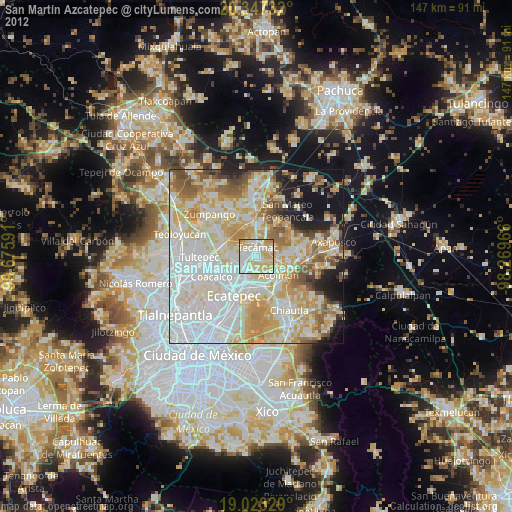
» Earth at Night: Flat Maps 2012, 2016