Ojo de Agua night lights from space
Night Light of Ojo de Agua (México) from space (Mexico) Src. Average luminocity for 10x10km area is 87.1074% and for 50x50km: 73.6391%.
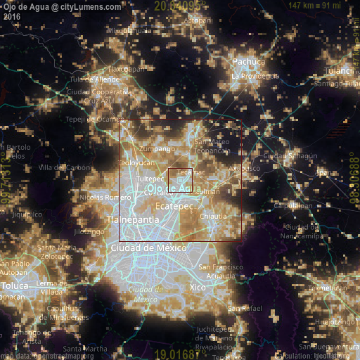
Analysis of Ojo de Agua night lights 2016
Square area 10x10 km:
 35.74%
90-99
22.11%80-89
11.78%70-79
13.02%60-69
8.06%50-59
8.06%40-49
1.24%30-39
0%20-29
0%10-19
0%0-9
0%Square area 50x50 km:
24.02%90-99
13.4%80-89
13.29%70-79
13.07%60-69
10.92%50-59
6.27%40-49
4.65%30-39
3.33%20-29
4.73%10-19
4.65%0-9
1.68%Clear (daylight) street map image can be seen on geolist.org.
Map coordinates:
20° 20' 27.4" North, 99° 42' 47.3" West
19° 40' 49" North, 99° 0' 36" West
19° 1' 0.7" North, 98° 18' 24.8" West
Some cities around Ojo de Agua sort by population:
• San Martín Azcatepec
4 km =2.5 mi,  79°
79°
• Tecámac de Felipe Villanueva
5.7 km =3.5 mi,  50°
50°
• Tecámac
5.6 km =3.5 mi, 49°
• Alborada Jaltenco
6.5 km =4 mi,  251°
251°
• Santo Tomás Chiconautla
4.6 km =2.9 mi,  176°
176°
• Tonanitla
4.6 km =2.9 mi,  280°
280°
• San Pablo Tecalco
5.5 km =3.4 mi,  98°
98°
• Ex-Hacienda Santa Inés
7.2 km =4.5 mi,  294°
294°
3827598 (p: 242,272)
Sources (retrieved 2019-11-25):
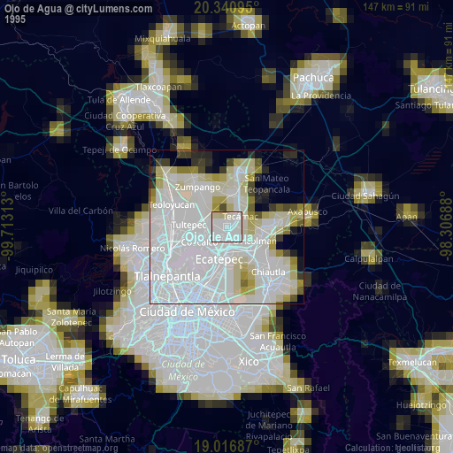
» NASA, Earths city lights 1995
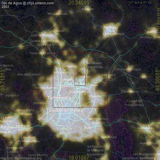
» NASA city lights 2003
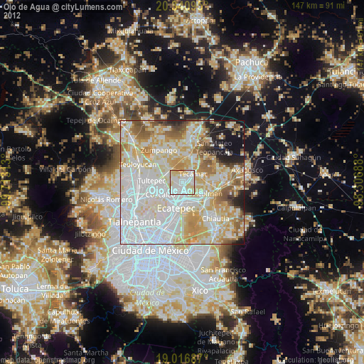
» Earth at Night: Flat Maps 2012, 2016