San Buenaventura night lights from space
Night Light of San Buenaventura (Coahuila) from space (Mexico) Src. Average luminocity for 10x10km area is 16.5615% and for 50x50km: 7.0966%.
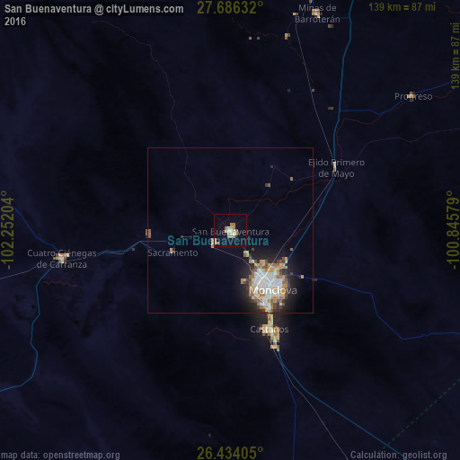
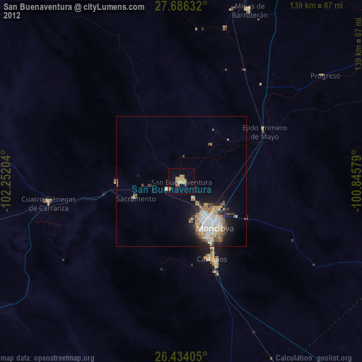
Analysis of San Buenaventura night lights 2016
Square area 10x10 km:
 0.4%
0.4%90-99
1.39%80-89
3.37%70-79
4.96%60-69
3.97%50-59
2.58%40-49
0%30-39
0%20-29
0.4%10-19
2.78%0-9
80.16%Square area 50x50 km:
1.13%90-99
1.3%80-89
0.87%70-79
1.08%60-69
1.13%50-59
0.87%40-49
0.7%30-39
0.74%20-29
1.81%10-19
3.35%0-9
87.01%Clear (daylight) street map image can be seen on geolist.org.
Map coordinates:
27° 41' 10.8" North, 102° 15' 7.3" West
27° 3' 42.9" North, 101° 32' 56.1" West
26° 26' 2.6" North, 100° 50' 44.8" West
Some cities around San Buenaventura sort by population:
• Monclova
21.4 km =13.3 mi,  143°
143°
• Frontera
17.7 km =11 mi,  147°
147°
• Sabinas
98 km =60.9 mi,  25°
25°
• Ciudad Melchor Múzquiz
90.9 km =56.5 mi,  2°
2°
• Castaños
32.4 km =20.1 mi,  159°
159°
• Palau
93.2 km =57.9 mi,  7°
7°
• Cuatro Ciénegas de Carranza
51.7 km =32.1 mi,  260°
260°
• Minas de Barroterán
70.6 km =43.9 mi,  21°
21°
3987500 (p: 20,480)
Sources (retrieved 2019-11-25):
» Earth at Night: Flat Maps 2012, 2016