San Antonio Tecómitl night lights from space
Night Light of San Antonio Tecómitl (Mexico City) from space (Mexico) Src. Average luminocity for 10x10km area is 79.1991% and for 50x50km: 54.1898%.
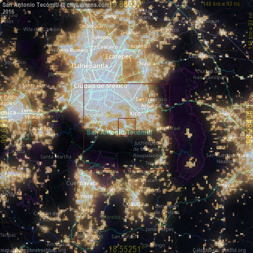
Analysis of San Antonio Tecómitl night lights 2016
Square area 10x10 km:
 15.8%
15.8%90-99
16.67%80-89
18.61%70-79
28.14%60-69
7.36%50-59
4.11%40-49
5.84%30-39
2.16%20-29
1.3%10-19
0%0-9
0%Square area 50x50 km:
23.8%90-99
9.25%80-89
7.81%70-79
6.33%60-69
4.03%50-59
2.29%40-49
3.61%30-39
2.51%20-29
6.46%10-19
10.91%0-9
23%Clear (daylight) street map image can be seen on geolist.org.
Map coordinates:
19° 52' 49.3" North, 99° 41' 28.3" West
19° 13' 4" North, 98° 59' 17" West
18° 33' 9" North, 98° 17' 5.8" West
Some cities around San Antonio Tecómitl sort by population:
• San Juan Ixtayopan
1.9 km =1.2 mi,  324°
324°
• Milpa Alta
4.6 km =2.9 mi,  232°
232°
• San Mateo Huitzilzingo
6.7 km =4.2 mi,  79°
79°
• San Juan y San Pedro Tezompa
3.1 km =1.9 mi,  113°
113°
• San Francisco Tecoxpa
3.5 km =2.2 mi,  213°
213°
• Santa Catarina Ayotzingo
6.2 km =3.9 mi,  98°
98°
• Santa Ana Tlacotenco
4.8 km =3 mi,  192°
192°
• San Pedro Atocpan
6.7 km =4.2 mi,  254°
254°
8858100 (p: 24,397)
Sources (retrieved 2019-11-25):
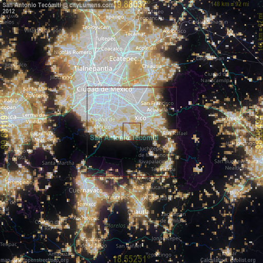
» Earth at Night: Flat Maps 2012, 2016