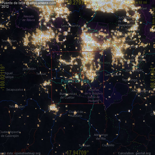
Puente de Ixtla night lights from space
Night Light of Puente de Ixtla (Morelos) from space (Mexico) Src. Average luminocity for 10x10km area is 30.1942% and for 50x50km: 18.0009%.
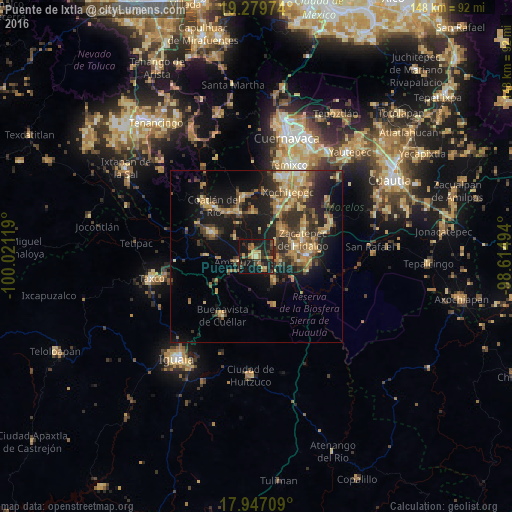
Analysis of Puente de Ixtla night lights 2016
Square area 10x10 km:
 0%
0%90-99
0.21%80-89
5.79%70-79
4.34%60-69
8.68%50-59
1.03%40-49
7.02%30-39
7.23%20-29
12.6%10-19
47.52%0-9
5.58%Square area 50x50 km:
0.37%90-99
0.84%80-89
3.34%70-79
3.57%60-69
3.91%50-59
2.39%40-49
3.59%30-39
4.03%20-29
5.75%10-19
14.12%0-9
58.11%Clear (daylight) street map image can be seen on geolist.org.
Map coordinates:
19° 16' 47.1" North, 100° 1' 16.3" West
18° 36' 53" North, 99° 19' 5" West
17° 56' 49.5" North, 98° 36' 53.8" West
Some cities around Puente de Ixtla sort by population:
• Zacatepec
14.2 km =8.8 mi,  72°
72°
• Xoxocotla
10.8 km =6.7 mi,  44°
44°
• Jojutla
14.5 km =9 mi,  90°
90°
• Galeana
11.4 km =7.1 mi,  76°
76°
• Coatetelco
12.8 km =8 mi,  356°
356°
• Tehuixtla
7.9 km =4.9 mi,  141°
141°
• Tlatenchi
14 km =8.7 mi,  98°
98°
• Amacuzac
5.7 km =3.5 mi,  251°
251°
3521051 (p: 21,098)
Sources (retrieved 2019-11-25):
» Earth at Night: Flat Maps 2012, 2016