Jojutla night lights from space
Night Light of Jojutla (Morelos) from space (Mexico) Src. Average luminocity for 10x10km area is 52.0537% and for 50x50km: 18.5258%.
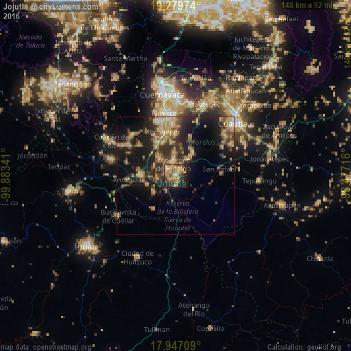
Analysis of Jojutla night lights 2016
Square area 10x10 km:
 2.48%
2.48%90-99
3.51%80-89
10.33%70-79
12.6%60-69
16.53%50-59
11.98%40-49
7.23%30-39
7.23%20-29
10.95%10-19
14.67%0-9
2.48%Square area 50x50 km:
0.52%90-99
1%80-89
3.62%70-79
3.56%60-69
4.04%50-59
2.51%40-49
3.78%30-39
3.8%20-29
5.95%10-19
14.27%0-9
56.94%Clear (daylight) street map image can be seen on geolist.org.
Map coordinates:
19° 16' 47.1" North, 99° 53' 0.3" West
18° 36' 53" North, 99° 10' 49" West
17° 56' 49.5" North, 98° 28' 37.8" West
Some cities around Jojutla sort by population:
• Zacatepec
4.5 km =2.8 mi,  347°
347°
• Xoxocotla
10.4 km =6.5 mi,  318°
318°
• Tlaquiltenango
2.8 km =1.7 mi,  39°
39°
• Santa Rosa Treinta
9.5 km =5.9 mi,  357°
357°
• Galeana
4.3 km =2.7 mi,  307°
307°
• Tlaltizapán
10.3 km =6.4 mi, 39°
• Tlatenchi
2.1 km =1.3 mi,  197°
197°
• Pedro Amaro
2.2 km =1.4 mi,  159°
159°
3526467 (p: 18,867)
Sources (retrieved 2019-11-25):
» Earth at Night: Flat Maps 2012, 2016