Nogales night lights from space
Night Light of Nogales (Sonora) from space (Mexico) Src. Average luminocity for 10x10km area is 63.5944% and for 50x50km: 6.8584%.
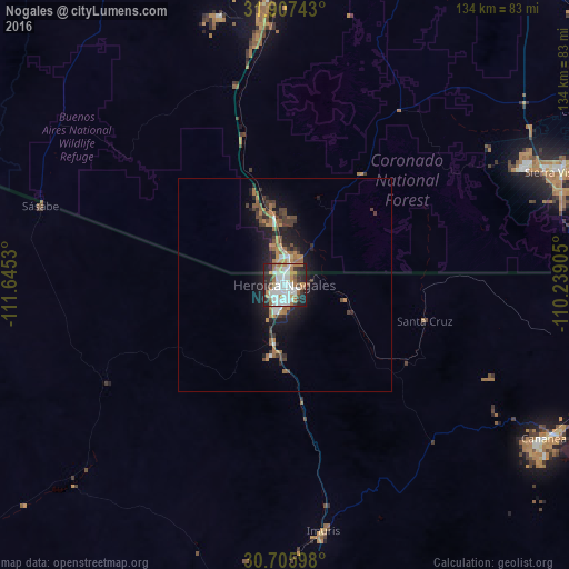
Analysis of Nogales night lights 2016
Square area 10x10 km:
 17.83%
90-99
19.41%80-89
2.62%70-79
5.94%60-69
13.29%50-59
3.67%40-49
2.62%30-39
8.22%20-29
19.93%10-19
6.47%0-9
0%Square area 50x50 km:
0.94%90-99
1.01%80-89
0.29%70-79
0.9%60-69
1.55%50-59
0.71%40-49
1.05%30-39
1.24%20-29
2.15%10-19
5.01%0-9
85.15%Clear (daylight) street map image can be seen on geolist.org.
Map coordinates:
31° 54' 26.7" North, 111° 38' 43.1" West
31° 18' 31" North, 110° 56' 31.8" West
30° 42' 21.5" North, 110° 14' 20.6" West
Some cities around Nogales sort by population:
• Sierra Vista, US
66.5 km =41.3 mi,  65°
65°
• Cananea
71.6 km =44.5 mi,  119°
119°
• Sahuarita, US
72.2 km =44.9 mi,  358°
358°
• Green Valley, US
60.9 km =37.8 mi, 355°
• Rio Rico, US
18.4 km =11.4 mi,  349°
349°
• Sierra Vista Southeast, US
70.8 km =44 mi,  76°
76°
• Imuris
58.4 km =36.3 mi,  170°
170°
• Corona de Tucson, US
74.7 km =46.4 mi,  12°
12°
4004886 (p: 212,533)
Sources (retrieved 2019-11-25):
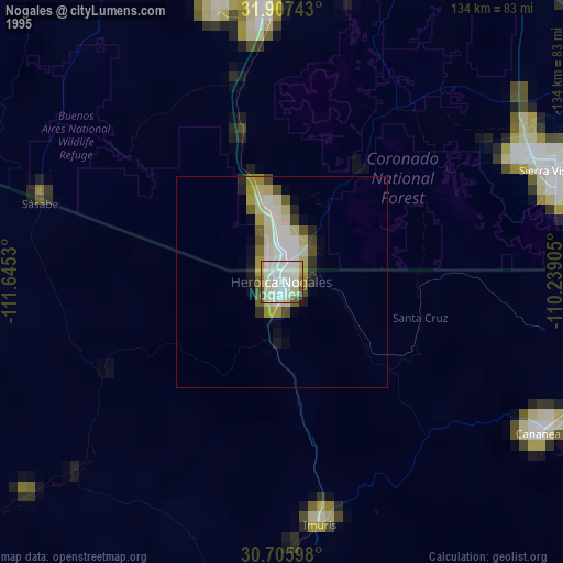
» NASA, Earths city lights 1995
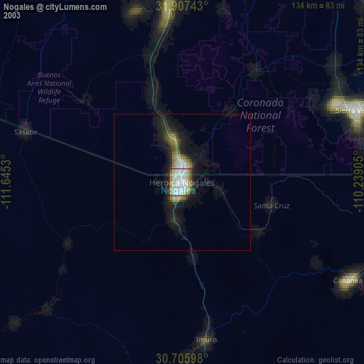
» NASA city lights 2003
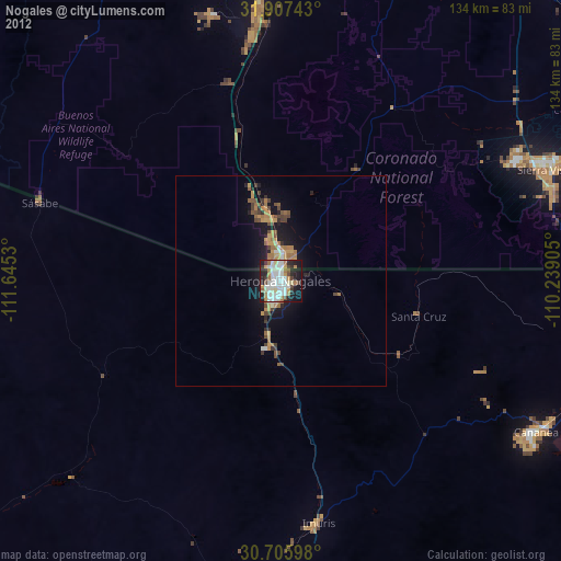
» Earth at Night: Flat Maps 2012, 2016