Nacozari Viejo night lights from space
Night Light of Nacozari Viejo (Sonora) from space (Mexico) Src. Average luminocity for 10x10km area is 7.4066% and for 50x50km: 0.9776%.
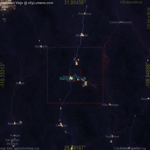
Analysis of Nacozari Viejo night lights 2016
Square area 10x10 km:
 0.55%
0.55%90-99
0.92%80-89
0%70-79
4.4%60-69
2.2%50-59
0%40-49
0%30-39
0.73%20-29
0.73%10-19
0%0-9
90.48%Square area 50x50 km:
0.04%90-99
0.05%80-89
0.03%70-79
0.36%60-69
0.21%50-59
0.11%40-49
0.21%30-39
0.24%20-29
0.14%10-19
0%0-9
98.61%Clear (daylight) street map image can be seen on geolist.org.
Map coordinates:
31° 0' 16.4" North, 110° 21' 11.3" West
30° 24' 0" North, 109° 39' 0" West
29° 47' 30" North, 108° 56' 48.8" West
Some cities around Nacozari Viejo sort by population:
• Agua Prieta
103.9 km =64.6 mi,  5°
5°
• Cananea
89.5 km =55.6 mi,  316°
316°
• Magdalena de Kino
128.2 km =79.7 mi,  281°
281°
• Douglas, US
105.5 km =65.6 mi, 5°
• Imuris
122.4 km =76.1 mi,  290°
290°
• Esqueda
36.5 km =22.7 mi, 9°
• Naco
106.9 km =66.4 mi,  344°
344°
• Bisbee, US
119.5 km =74.3 mi,  347°
347°
3995155 (p: 11,872)
Sources (retrieved 2019-11-25):
» Earth at Night: Flat Maps 2012, 2016