Mixquiahuala de Juarez night lights from space
Night Light of Mixquiahuala de Juarez (Hidalgo) from space (Mexico) Src. Average luminocity for 10x10km area is 35.504% and for 50x50km: 19.7126%.
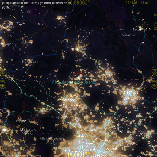
Analysis of Mixquiahuala de Juarez night lights 2016
Square area 10x10 km:
 0%
0%90-99
2.58%80-89
7.74%70-79
6.55%60-69
8.93%50-59
2.38%40-49
5.56%30-39
5.56%20-29
17.66%10-19
40.08%0-9
2.98%Square area 50x50 km:
0.54%90-99
1.07%80-89
2.83%70-79
3.32%60-69
5.16%50-59
2.75%40-49
4.31%30-39
4.76%20-29
5.98%10-19
14.6%0-9
54.67%Clear (daylight) street map image can be seen on geolist.org.
Map coordinates:
20° 53' 19.1" North, 99° 55' 1.5" West
20° 13' 49.1" North, 99° 12' 50.3" West
19° 34' 9" North, 98° 30' 39" West
Some cities around Mixquiahuala de Juarez sort by population:
• Progreso de Alvaro Obregon
3.3 km =2.1 mi,  49°
49°
• Tlaxcoapan
15.4 km =9.6 mi,  182°
182°
• Tepatepec
13.1 km =8.1 mi,  82°
82°
• Tetepango
15.7 km =9.8 mi,  155°
155°
• Tlahuelilpan
11.2 km =7 mi,  189°
189°
• Presas
8.8 km =5.5 mi,  206°
206°
• San Juan Tepa
15.5 km =9.6 mi,  95°
95°
• Huitel
9.7 km =6 mi,  223°
223°
3523127 (p: 25,510)
Sources (retrieved 2019-11-25):
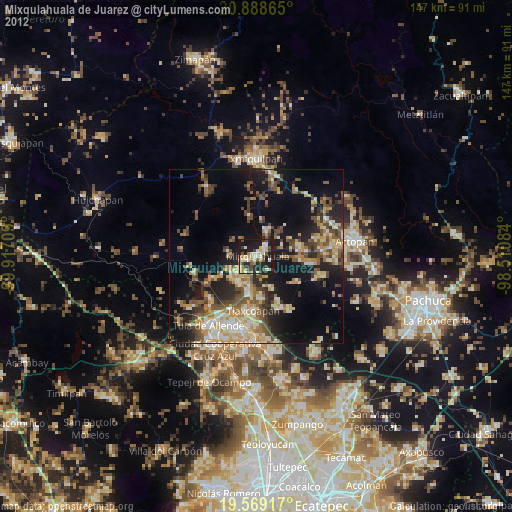
» Earth at Night: Flat Maps 2012, 2016