Lombardía night lights from space
Night Light of Lombardía (Michoacán) from space (Mexico) Src. Average luminocity for 10x10km area is 6% and for 50x50km: 2.193%.
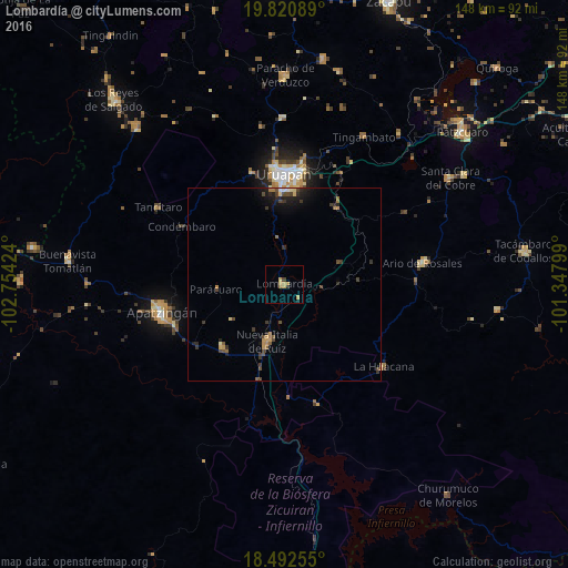
Analysis of Lombardía night lights 2016
Square area 10x10 km:
 0%
0%90-99
0%80-89
0.87%70-79
3.68%60-69
1.52%50-59
0%40-49
0.87%30-39
0.43%20-29
0.43%10-19
0.87%0-9
91.34%Square area 50x50 km:
0.06%90-99
0.06%80-89
0.22%70-79
0.47%60-69
0.31%50-59
0.2%40-49
0.73%30-39
0.58%20-29
0.57%10-19
1.27%0-9
95.53%Clear (daylight) street map image can be seen on geolist.org.
Map coordinates:
19° 49' 15.2" North, 102° 45' 15.3" West
19° 9' 29" North, 102° 3' 4" West
18° 29' 33.2" North, 101° 20' 52.8" West
Some cities around Lombardía sort by population:
• Uruapan
28.1 km =17.5 mi,  358°
358°
• Apatzingán
33.1 km =20.6 mi,  256°
256°
• Nueva Italia de Ruiz
15.4 km =9.6 mi,  196°
196°
• Nuevo San Juan Parangaricutiro
30.2 km =18.8 mi,  343°
343°
• Antúnez (Morelos)
22.8 km =14.2 mi,  224°
224°
• Antúnez
22.7 km =14.1 mi,  225°
225°
• Taretán
24 km =14.9 mi,  35°
35°
• Caltzontzín
29.9 km =18.6 mi,  8°
8°
3998318 (p: 12,610)
Sources (retrieved 2019-11-25):
» Earth at Night: Flat Maps 2012, 2016