Apatzingán night lights from space
Night Light of Apatzingán (Michoacán) from space (Mexico) Src. Average luminocity for 10x10km area is 34.8571% and for 50x50km: 2.5361%.
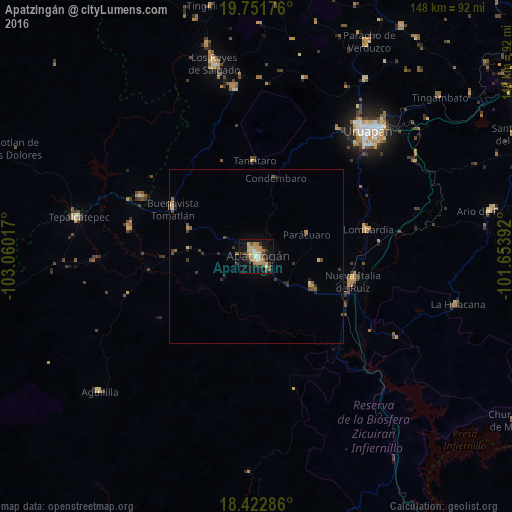
Analysis of Apatzingán night lights 2016
Square area 10x10 km:
 0%
0%90-99
5.41%80-89
4.98%70-79
11.04%60-69
7.14%50-59
4.11%40-49
3.25%30-39
8.23%20-29
1.73%10-19
34.85%0-9
19.26%Square area 50x50 km:
0%90-99
0.24%80-89
0.31%70-79
0.59%60-69
0.39%50-59
0.33%40-49
0.48%30-39
0.77%20-29
0.25%10-19
1.58%0-9
95.06%Clear (daylight) street map image can be seen on geolist.org.
Map coordinates:
19° 45' 6.3" North, 103° 3' 36.6" West
19° 5' 19.1" North, 102° 21' 25.3" West
18° 25' 22.3" North, 101° 39' 14.1" West
Some cities around Apatzingán sort by population:
• Nueva Italia de Ruiz
28.6 km =17.8 mi,  104°
104°
• Nuevo San Juan Parangaricutiro
43.7 km =27.2 mi,  32°
32°
• Lombardía
33.1 km =20.6 mi,  76°
76°
• Buenavista Tomatlán
27.9 km =17.3 mi,  299°
299°
• Felipe Carrillo Puerto
37.8 km =23.5 mi,  282°
282°
• Antúnez (Morelos)
18.2 km =11.3 mi,  117°
117°
• Antúnez
18 km =11.2 mi, 117°
• Tancítaro
27.8 km =17.3 mi,  358°
358°
4018400 (p: 99,010)
Sources (retrieved 2019-11-25):
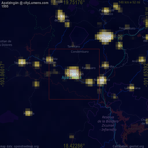
» NASA, Earths city lights 1995
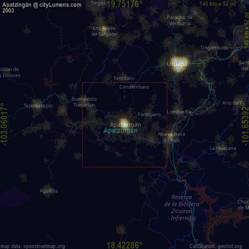
» NASA city lights 2003
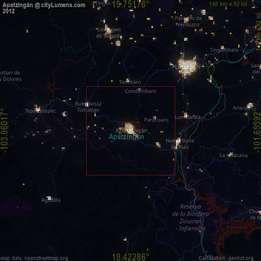
» Earth at Night: Flat Maps 2012, 2016