Ciudad Delicias night lights from space
Night Light of Ciudad Delicias (Chihuahua) from space (Mexico) Src. Average luminocity for 10x10km area is 61.1329% and for 50x50km: 7.7291%.
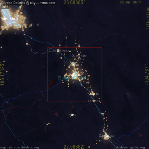
Analysis of Ciudad Delicias night lights 2016
Square area 10x10 km:
 8.53%
8.53%90-99
11.71%80-89
15.28%70-79
14.48%60-69
2.58%50-59
4.17%40-49
11.11%30-39
9.72%20-29
20.04%10-19
2.38%0-9
0%Square area 50x50 km:
0.41%90-99
0.61%80-89
1.59%70-79
1.4%60-69
0.74%50-59
1.08%40-49
1.37%30-39
1.26%20-29
2.6%10-19
4.8%0-9
84.14%Clear (daylight) street map image can be seen on geolist.org.
Map coordinates:
28° 48' 29" North, 106° 10' 23.7" West
28° 11' 24.5" North, 105° 28' 12.4" West
27° 34' 7" North, 104° 46' 1.2" West
Some cities around Ciudad Delicias sort by population:
• Camargo
64 km =39.8 mi,  152°
152°
• Jiménez
17.3 km =10.7 mi,  23°
23°
• Meoqui
9.2 km =5.7 mi,  353°
353°
• Saucillo
24.8 km =15.4 mi,  135°
135°
• Lázaro Cárdenas
26.9 km =16.7 mi,  326°
326°
• Ampliación Colonia Lázaro Cárdenas
25.8 km =16 mi, 326°
• Santa Eulalia
60.8 km =37.8 mi,  317°
317°
• Rosales
8.5 km =5.3 mi,  268°
268°
4013720 (p: 118,071)
Sources (retrieved 2019-11-25):
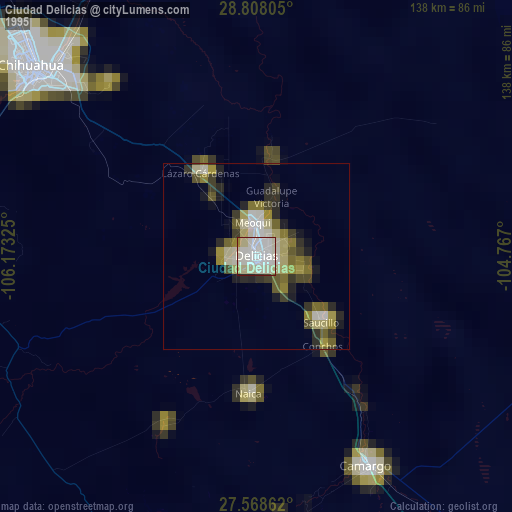
» NASA, Earths city lights 1995
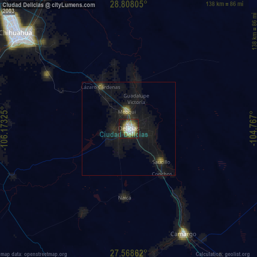
» NASA city lights 2003
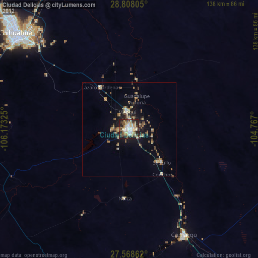
» Earth at Night: Flat Maps 2012, 2016