Jolalpan night lights from space
Night Light of Jolalpan (Puebla) from space (Mexico) Src. Average luminocity for 10x10km area is 1.6839% and for 50x50km: 2.0053%.
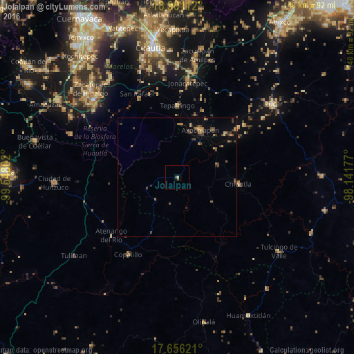
Analysis of Jolalpan night lights 2016
Square area 10x10 km:
 0%
0%90-99
0%80-89
0.83%70-79
0%60-69
0%50-59
0.83%40-49
0.83%30-39
0%20-29
0%10-19
0.83%0-9
96.69%Square area 50x50 km:
0%90-99
0.01%80-89
0.31%70-79
0.27%60-69
0.47%50-59
0.32%40-49
0.7%30-39
0.44%20-29
0.3%10-19
0.33%0-9
96.85%Clear (daylight) street map image can be seen on geolist.org.
Map coordinates:
18° 59' 28" North, 99° 32' 52.9" West
18° 19' 29.8" North, 98° 50' 41.6" West
17° 39' 22.4" North, 98° 8' 30.4" West
Some cities around Jolalpan sort by population:
• Axochiapan
22 km =13.7 mi,  26°
26°
• Tepalcingo
30 km =18.6 mi,  359°
359°
• Chiautla de Tapia
25.6 km =15.9 mi,  95°
95°
• Atencingo
32.8 km =20.4 mi,  50°
50°
• Ciudad de Chiautla de Tapia
25.6 km =15.9 mi, 96°
• Jonacatepec
39.8 km =24.7 mi,  6°
6°
• Copalillo
38.4 km =23.9 mi,  212°
212°
• Chietla
35.5 km =22.1 mi, 52°
3819050 (p: 7,022)
Sources (retrieved 2019-11-25):
» Earth at Night: Flat Maps 2012, 2016