Atencingo night lights from space
Night Light of Atencingo (Puebla) from space (Mexico) Src. Average luminocity for 10x10km area is 18.7769% and for 50x50km: 6.8481%.
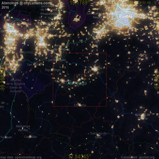
Analysis of Atencingo night lights 2016
Square area 10x10 km:
 0%
0%90-99
0.41%80-89
4.55%70-79
2.27%60-69
3.93%50-59
1.24%40-49
4.55%30-39
6.82%20-29
0.62%10-19
8.06%0-9
67.56%Square area 50x50 km:
0.03%90-99
0.14%80-89
1.3%70-79
1.01%60-69
1.21%50-59
1.1%40-49
1.64%30-39
1.45%20-29
1.18%10-19
4%0-9
86.94%Clear (daylight) street map image can be seen on geolist.org.
Map coordinates:
19° 10' 44" North, 99° 18' 30.8" West
18° 30' 48.5" North, 98° 36' 19.5" West
17° 50' 43.6" North, 97° 54' 8.3" West
Some cities around Atencingo sort by population:
• Izúcar de Matamoros
18.1 km =11.2 mi,  57°
57°
• Axochiapan
15.7 km =9.8 mi,  265°
265°
• Tepalcingo
26.9 km =16.7 mi,  289°
289°
• Chiautla de Tapia
23.6 km =14.7 mi,  179°
179°
• Ciudad de Chiautla de Tapia
23.7 km =14.7 mi, 179°
• Jonacatepec
28 km =17.4 mi,  311°
311°
• Chietla
2.9 km =1.8 mi,  74°
74°
• Amayuca
31 km =19.3 mi,  319°
319°
3532636 (p: 10,879)
Sources (retrieved 2019-11-25):
» Earth at Night: Flat Maps 2012, 2016