Jonacatepec night lights from space
Night Light of Jonacatepec (Morelos) from space (Mexico) Src. Average luminocity for 10x10km area is 23.5868% and for 50x50km: 16.5538%.
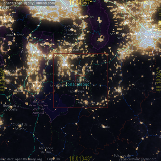
Analysis of Jonacatepec night lights 2016
Square area 10x10 km:
 0%
0%90-99
0%80-89
4.55%70-79
5.99%60-69
6.61%50-59
1.86%40-49
4.34%30-39
3.51%20-29
2.69%10-19
27.89%0-9
42.56%Square area 50x50 km:
0.54%90-99
1.06%80-89
2.92%70-79
2.98%60-69
3.66%50-59
2.28%40-49
4.11%30-39
3.14%20-29
3.43%10-19
10.14%0-9
65.73%Clear (daylight) street map image can be seen on geolist.org.
Map coordinates:
19° 20' 44.1" North, 99° 30' 23.4" West
18° 40' 50.9" North, 98° 48' 12.1" West
18° 0' 48.3" North, 98° 6' 0.9" West
Some cities around Jonacatepec sort by population:
• Cuautla
20 km =12.4 mi,  316°
316°
• Axochiapan
20.5 km =12.7 mi,  165°
165°
• Juan Morales
19.1 km =11.9 mi, 319°
• Tepalcingo
10.5 km =6.5 mi,  204°
204°
• Tenextepango
17.1 km =10.6 mi,  288°
288°
• Temoac
10.5 km =6.5 mi,  14°
14°
• Amayuca
4.8 km =3 mi, 6°
• Tlacotepec
16.1 km =10 mi,  22°
22°
3526458 (p: 8,123)
Sources (retrieved 2019-11-25):
» Earth at Night: Flat Maps 2012, 2016