Galaxia la Noria night lights from space
Night Light of Galaxia la Noria (Jalisco) from space (Mexico) Src. Average luminocity for 10x10km area is 58.3598% and for 50x50km: 39.5769%.
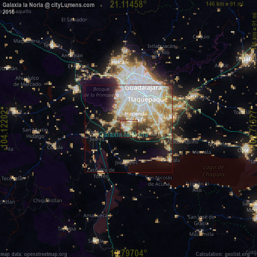
Analysis of Galaxia la Noria night lights 2016
Square area 10x10 km:
 6.63%
6.63%90-99
10.42%80-89
13.45%70-79
8.71%60-69
10.61%50-59
10.04%40-49
9.47%30-39
8.14%20-29
13.07%10-19
9.28%0-9
0.19%Square area 50x50 km:
11.01%90-99
7.36%80-89
7.6%70-79
5.77%60-69
3.77%50-59
3.23%40-49
3.7%30-39
3.46%20-29
4.29%10-19
8.63%0-9
41.18%Clear (daylight) street map image can be seen on geolist.org.
Map coordinates:
21° 6' 52.5" North, 104° 7' 19.3" West
20° 27' 26" North, 103° 25' 8" West
19° 47' 49.3" North, 102° 42' 56.8" West
Some cities around Galaxia la Noria sort by population:
• Hacienda Santa Fe
7.9 km =4.9 mi,  30°
30°
• Tlajomulco de Zúñiga
3.4 km =2.1 mi,  303°
303°
• San Sebastián el Grande
8.5 km =5.3 mi,  353°
353°
• Lomas del Sur
3.9 km =2.4 mi,  2°
2°
• Santa Cruz del Valle
8.6 km =5.3 mi, 349°
• Villas de la Hacienda [Fraccionamiento]
9 km =5.6 mi,  24°
24°
• San Miguel Cuyutlán
5.5 km =3.4 mi,  146°
146°
• Colinas del Roble
5.6 km =3.5 mi, 22°
8858245 (p: 5,681)
Sources (retrieved 2019-11-25):
» Earth at Night: Flat Maps 2012, 2016