Huamantla night lights from space
Night Light of Huamantla (Tlaxcala) from space (Mexico) Src. Average luminocity for 10x10km area is 37.0868% and for 50x50km: 21.2348%.
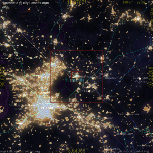
Analysis of Huamantla night lights 2016
Square area 10x10 km:
 3.1%
3.1%90-99
5.17%80-89
5.79%70-79
3.93%60-69
6.4%50-59
4.96%40-49
9.3%30-39
5.17%20-29
10.12%10-19
43.18%0-9
2.89%Square area 50x50 km:
0.77%90-99
1.5%80-89
5.2%70-79
3.48%60-69
3.74%50-59
2.35%40-49
4.44%30-39
3.43%20-29
5.17%10-19
15.08%0-9
54.83%Clear (daylight) street map image can be seen on geolist.org.
Map coordinates:
19° 58' 36.1" North, 98° 37' 42" West
19° 18' 52.2" North, 97° 55' 30.7" West
18° 38' 58.7" North, 97° 13' 19.5" West
Some cities around Huamantla sort by population:
• Grajales
16 km =9.9 mi,  126°
126°
• Ignacio Zaragoza
2.5 km =1.6 mi,  170°
170°
• Nopalucán
15.2 km =9.4 mi, 134°
• Ixtenco
7.7 km =4.8 mi,  155°
155°
• Zitlaltépec
12.4 km =7.7 mi, 171°
• San José Xicohténcatl
10.9 km =6.8 mi,  65°
65°
• Tocatlán
13.5 km =8.4 mi,  307°
307°
• San José Teacalco
14.8 km =9.2 mi,  279°
279°
3815324 (p: 51,996)
Sources (retrieved 2019-11-25):
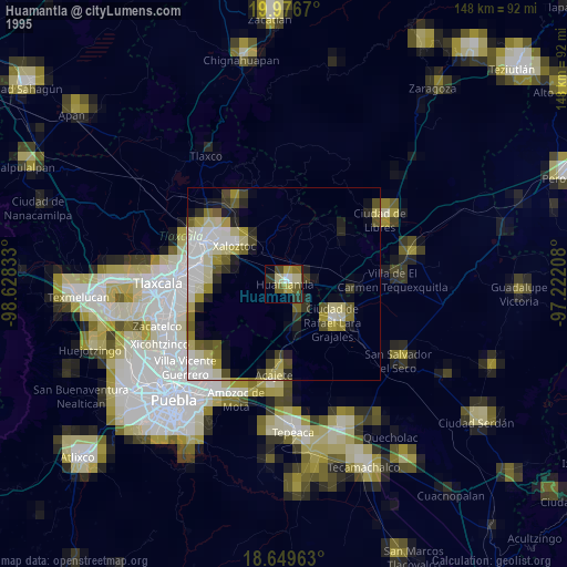
» NASA, Earths city lights 1995
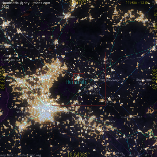
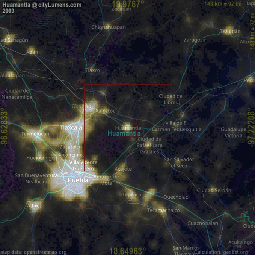
» NASA city lights 2003
» Earth at Night: Flat Maps 2012, 2016