Ignacio Zaragoza night lights from space
Night Light of Ignacio Zaragoza (Tlaxcala) from space (Mexico) Src. Average luminocity for 10x10km area is 35.2035% and for 50x50km: 22.3328%.
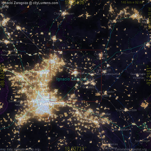
Analysis of Ignacio Zaragoza night lights 2016
Square area 10x10 km:
 2.81%
2.81%90-99
6.06%80-89
6.49%70-79
3.9%60-69
4.98%50-59
4.33%40-49
8.87%30-39
3.46%20-29
6.28%10-19
40.48%0-9
12.34%Square area 50x50 km:
1.07%90-99
1.79%80-89
5.17%70-79
3.57%60-69
3.84%50-59
2.73%40-49
4.62%30-39
3.5%20-29
5.53%10-19
15.12%0-9
53.05%Clear (daylight) street map image can be seen on geolist.org.
Map coordinates:
19° 57' 16.4" North, 98° 37' 27.7" West
19° 17' 32.2" North, 97° 55' 16.4" West
18° 37' 38.3" North, 97° 13' 5.2" West
Some cities around Ignacio Zaragoza sort by population:
• Huamantla
2.5 km =1.6 mi,  350°
350°
• Grajales
14.3 km =8.9 mi,  119°
119°
• Nopalucán
13.2 km =8.2 mi,  128°
128°
• Ixtenco
5.4 km =3.4 mi,  147°
147°
• Zitlaltépec
9.9 km =6.2 mi,  171°
171°
• San José Xicohténcatl
11.7 km =7.3 mi,  53°
53°
• Tocatlán
15.5 km =9.6 mi,  313°
313°
• El Rincón Citlaltépetl
15.5 km =9.6 mi, 169°
3815325 (p: 6,916)
Sources (retrieved 2019-11-25):
» Earth at Night: Flat Maps 2012, 2016