Coscomatepec de Bravo night lights from space
Night Light of Coscomatepec de Bravo (Veracruz) from space (Mexico) Src. Average luminocity for 10x10km area is 5.6082% and for 50x50km: 10.5565%.
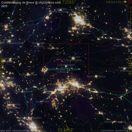
Analysis of Coscomatepec de Bravo night lights 2016
Square area 10x10 km:
 0%
0%90-99
1.08%80-89
1.52%70-79
0%60-69
0.87%50-59
0%40-49
1.95%30-39
1.08%20-29
0.87%10-19
0%0-9
92.64%Square area 50x50 km:
0.84%90-99
1.34%80-89
1.02%70-79
1.57%60-69
2.57%50-59
1.17%40-49
2.33%30-39
2.54%20-29
2.59%10-19
5.1%0-9
78.92%Clear (daylight) street map image can be seen on geolist.org.
Map coordinates:
19° 44' 9.3" North, 97° 44' 59.9" West
19° 4' 21.9" North, 97° 2' 48.7" West
18° 24' 24.8" North, 96° 20' 37.4" West
Some cities around Coscomatepec de Bravo sort by population:
• Huatusco
11.9 km =7.4 mi,  44°
44°
• Fortín de las Flores
19 km =11.8 mi,  164°
164°
• Córdoba (Santa Leticia)
19.6 km =12.2 mi, 158°
• Chocamán
6.9 km =4.3 mi,  167°
167°
• Atzacan
18.8 km =11.7 mi,  191°
191°
• Xocotla
8.6 km =5.3 mi,  221°
221°
• Monte Blanco
12.2 km =7.6 mi, 165°
• Ixhuatlán del Café
7 km =4.3 mi,  109°
109°
3530175 (p: 15,252)
Sources (retrieved 2019-11-25):
» Earth at Night: Flat Maps 2012, 2016