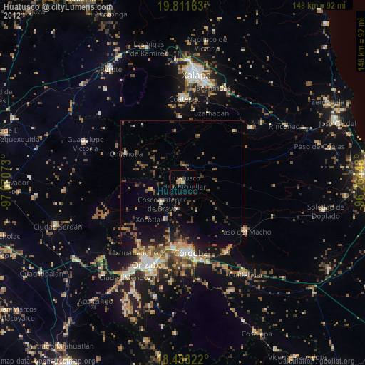
Huatusco night lights from space
Night Light of Huatusco (Veracruz) from space (Mexico) Src. Average luminocity for 10x10km area is 9.5866% and for 50x50km: 3.2974%.
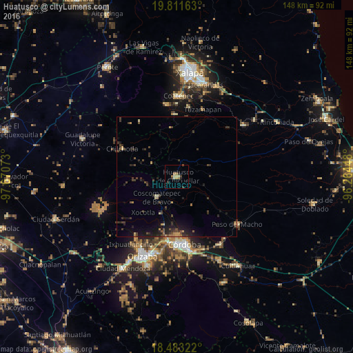
Analysis of Huatusco night lights 2016
Square area 10x10 km:
 0%
0%90-99
0.43%80-89
2.16%70-79
1.73%60-69
3.9%50-59
0%40-49
1.08%30-39
2.81%20-29
1.3%10-19
0%0-9
86.58%Square area 50x50 km:
0%90-99
0.08%80-89
0.29%70-79
0.46%60-69
0.42%50-59
0.31%40-49
1.1%30-39
1.19%20-29
1.33%10-19
2.38%0-9
92.45%Clear (daylight) street map image can be seen on geolist.org.
Map coordinates:
19° 48' 41.9" North, 97° 40' 14.6" West
19° 8' 55.5" North, 96° 58' 3.4" West
18° 28' 59.6" North, 96° 15' 52.1" West
Some cities around Huatusco sort by population:
• Fortín de las Flores
27 km =16.8 mi,  187°
187°
• Coscomatepec de Bravo
11.9 km =7.4 mi,  224°
224°
• Córdoba (Santa Leticia)
26.7 km =16.6 mi,  182°
182°
• Chocamán
16.7 km =10.4 mi,  204°
204°
• Teocelo
26.3 km =16.3 mi,  358°
358°
• Xocotla
20.4 km =12.7 mi, 223°
• Monte Blanco
20.9 km =13 mi, 194°
• Ixhuatlán del Café
11 km =6.8 mi, 188°
3526993 (p: 31,305)
Sources (retrieved 2019-11-25):
» Earth at Night: Flat Maps 2012, 2016