Camargo night lights from space
Night Light of Camargo (Chihuahua) from space (Mexico) Src. Average luminocity for 10x10km area is 30.6448% and for 50x50km: 1.9548%.
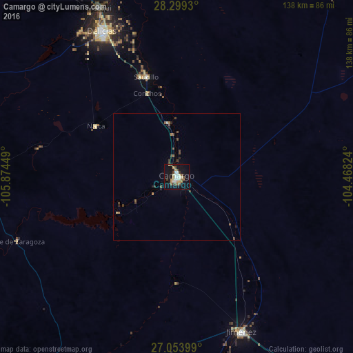

Analysis of Camargo night lights 2016
Square area 10x10 km:
 4.37%
4.37%90-99
5.56%80-89
3.97%70-79
5.56%60-69
2.78%50-59
5.36%40-49
1.19%30-39
2.98%20-29
0.79%10-19
40.67%0-9
26.79%Square area 50x50 km:
0.17%90-99
0.21%80-89
0.21%70-79
0.25%60-69
0.23%50-59
0.48%40-49
0.28%30-39
0.28%20-29
0.19%10-19
1.79%0-9
95.9%Clear (daylight) street map image can be seen on geolist.org.
Map coordinates:
28° 17' 57.5" North, 105° 52' 28.2" West
27° 40' 42.3" North, 105° 10' 16.9" West
27° 3' 14.4" North, 104° 28' 5.7" West
Some cities around Camargo sort by population:
• Ciudad Delicias
64 km =39.8 mi,  332°
332°
• José Mariano Jiménez
65.6 km =40.8 mi,  158°
158°
• Jiménez
76.2 km =47.3 mi,  342°
342°
• Meoqui
72.7 km =45.2 mi, 335°
• Saucillo
41 km =25.5 mi, 342°
• Lázaro Cárdenas
90.8 km =56.4 mi, 330°
• Ampliación Colonia Lázaro Cárdenas
89.7 km =55.7 mi, 330°
• Rosales
68.1 km =42.3 mi, 326°
4013724 (p: 40,221)
Sources (retrieved 2019-11-25):
» Earth at Night: Flat Maps 2012, 2016