Cihuatlán night lights from space
Night Light of Cihuatlán (Jalisco) from space (Mexico) Src. Average luminocity for 10x10km area is 7.3355% and for 50x50km: 3.2943%.
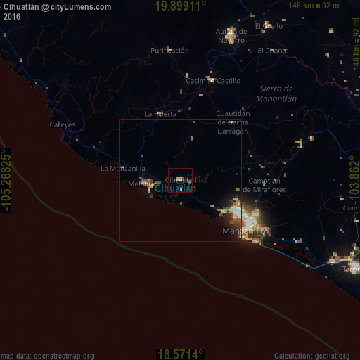
Analysis of Cihuatlán night lights 2016
Square area 10x10 km:
 0%
0%90-99
0%80-89
2.6%70-79
0%60-69
3.46%50-59
0%40-49
1.73%30-39
0%20-29
3.46%10-19
0.87%0-9
87.88%Square area 50x50 km:
0.26%90-99
0.27%80-89
0.46%70-79
0.45%60-69
0.52%50-59
0.56%40-49
0.78%30-39
0.66%20-29
0.91%10-19
1.91%0-9
93.23%Clear (daylight) street map image can be seen on geolist.org.
Map coordinates:
19° 53' 56.8" North, 105° 16' 5.7" West
19° 14' 11.8" North, 104° 33' 54.4" West
18° 34' 17" North, 103° 51' 43.2" West
Some cities around Cihuatlán sort by population:
• Manzanillo
26.9 km =16.7 mi,  119°
119°
• Autlán de Navarro
62.7 km =39 mi,  19°
19°
• La Resolana
43.2 km =26.8 mi, 18°
• El Colomo
37.7 km =23.4 mi, 121°
• La Huerta
28.8 km =17.9 mi,  343°
343°
• San Patricio
14.7 km =9.1 mi,  265°
265°
• Las Juntas
26.2 km =16.3 mi,  325°
325°
• Cofradía de Juárez
70.9 km =44.1 mi, 115°
3976999 (p: 18,164)
Sources (retrieved 2019-11-25):
» Earth at Night: Flat Maps 2012, 2016