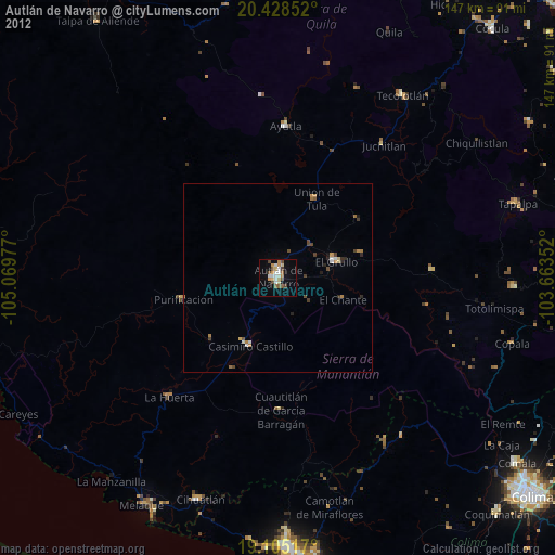
Autlán de Navarro night lights from space
Night Light of Autlán de Navarro (Jalisco) from space (Mexico) Src. Average luminocity for 10x10km area is 20.2231% and for 50x50km: 1.91%.
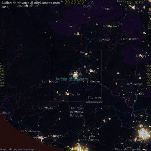
Analysis of Autlán de Navarro night lights 2016
Square area 10x10 km:
 0.21%
0.21%90-99
0.62%80-89
6.61%70-79
3.72%60-69
7.02%50-59
1.24%40-49
1.24%30-39
0.62%20-29
1.03%10-19
7.23%0-9
70.45%Square area 50x50 km:
0.01%90-99
0.03%80-89
0.48%70-79
0.44%60-69
0.58%50-59
0.17%40-49
0.29%30-39
0.11%20-29
0.24%10-19
0.46%0-9
97.18%Clear (daylight) street map image can be seen on geolist.org.
Map coordinates:
20° 25' 42.7" North, 105° 4' 11.2" West
19° 46' 5.6" North, 104° 21' 59.9" West
19° 6' 18.6" North, 103° 39' 48.7" West
Some cities around Autlán de Navarro sort by population:
• El Grullo
16.1 km =10 mi,  74°
74°
• San Gabriel
38.4 km =23.9 mi,  90°
90°
• La Resolana
19.5 km =12.1 mi,  201°
201°
• Unión de Tula
23.3 km =14.5 mi,  26°
26°
• La Huerta
42.9 km =26.7 mi,  222°
222°
• Ayutla
40.2 km =25 mi,  3°
3°
• Las Juntas
51.7 km =32.1 mi, 223°
• La Tijera
15.1 km =9.4 mi,  346°
346°
4017957 (p: 45,382)
Sources (retrieved 2019-11-25):
» Earth at Night: Flat Maps 2012, 2016