Comalcalco night lights from space
Night Light of Comalcalco (Tabasco) from space (Mexico) Src. Average luminocity for 10x10km area is 56.7913% and for 50x50km: 30.7554%.
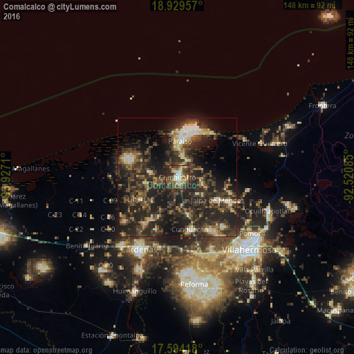
Analysis of Comalcalco night lights 2016
Square area 10x10 km:
 4.13%
4.13%90-99
9.71%80-89
13.43%70-79
4.34%60-69
8.26%50-59
11.98%40-49
18.39%30-39
15.7%20-29
13.64%10-19
0.41%0-9
0%Square area 50x50 km:
1.41%90-99
3.48%80-89
4.26%70-79
2.14%60-69
3.21%50-59
5.51%40-49
9.04%30-39
12.3%20-29
18.15%10-19
18.27%0-9
22.24%Clear (daylight) street map image can be seen on geolist.org.
Map coordinates:
18° 55' 46.5" North, 93° 55' 37.6" West
18° 15' 47.4" North, 93° 13' 26.3" West
17° 35' 39" North, 92° 31' 15.1" West
Some cities around Comalcalco sort by population:
• Paraiso
15.4 km =9.6 mi,  3°
3°
• Jalpa de Méndez
19.6 km =12.2 mi,  119°
119°
• Villa Tecolutilla
11.8 km =7.3 mi,  280°
280°
• Chichicapa
4.4 km =2.7 mi,  91°
91°
• Ayapa
12.6 km =7.8 mi,  110°
110°
• Miguel Hidalgo
9.2 km =5.7 mi,  265°
265°
• Villa Aldama
13.6 km =8.5 mi,  259°
259°
• Quintín Arauz
12.2 km =7.6 mi, 2°
3530385 (p: 41,458)
Sources (retrieved 2019-11-25):
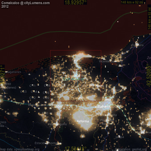
» Earth at Night: Flat Maps 2012, 2016