Campeche night lights from space
Night Light of Campeche from space (Mexico) Src. Average luminocity for 10x10km area is 73.671% and for 50x50km: 7.0378%.
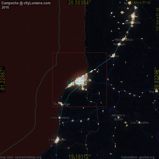
Analysis of Campeche night lights 2016
Square area 10x10 km:
 27.27%
90-99
30.95%80-89
4.11%70-79
0.22%60-69
2.81%50-59
5.41%40-49
4.76%30-39
3.46%20-29
14.29%10-19
6.28%0-9
0.43%Square area 50x50 km:
1.19%90-99
2.18%80-89
0.63%70-79
0.36%60-69
0.45%50-59
0.55%40-49
0.66%30-39
1.02%20-29
2.28%10-19
4.53%0-9
86.15%Clear (daylight) street map image can be seen on geolist.org.
Map coordinates:
20° 30' 13.8" North, 91° 13' 43.2" West
19° 50' 37.9" North, 90° 31' 31.9" West
19° 10' 52" North, 89° 49' 20.7" West
Some cities around Campeche sort by population:
• Champotón
58.8 km =36.5 mi,  200°
200°
• Dzitbalché
72 km =44.7 mi,  42°
42°
• Hecelchakán
55.2 km =34.3 mi,  47°
47°
• Seybaplaya
28.3 km =17.6 mi,  216°
216°
• Pomuch
49.1 km =30.5 mi, 48°
• Lerma
9 km =5.6 mi,  240°
240°
• Tenabo
38.2 km =23.7 mi,  55°
55°
• Chiná
8.8 km =5.5 mi,  159°
159°
3531732 (p: 220,389)
Sources (retrieved 2019-11-25):
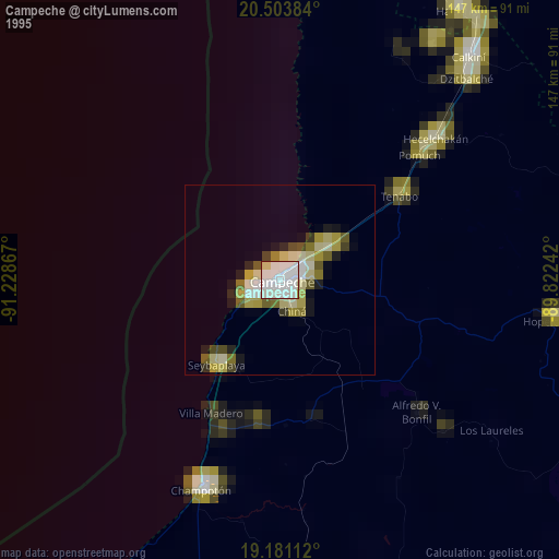
» NASA, Earths city lights 1995
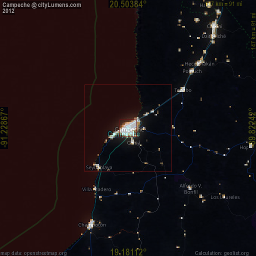
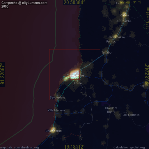
» NASA city lights 2003
» Earth at Night: Flat Maps 2012, 2016