Atotonilco el Alto night lights from space
Night Light of Atotonilco el Alto (Jalisco) from space (Mexico) Src. Average luminocity for 10x10km area is 22.6629% and for 50x50km: 7.6814%.
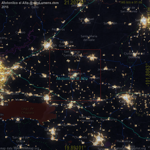
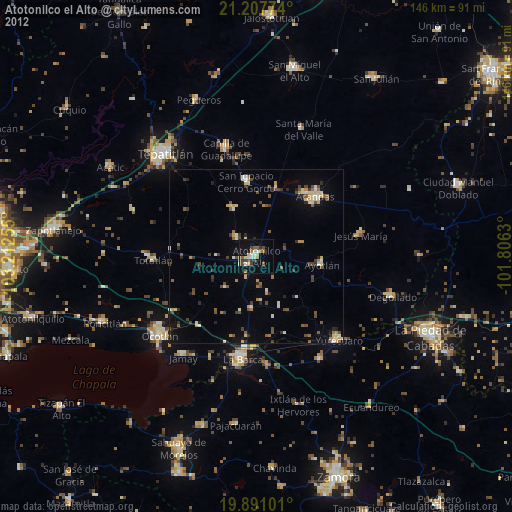
Analysis of Atotonilco el Alto night lights 2016
Square area 10x10 km:
 0.76%
0.76%90-99
2.08%80-89
4.36%70-79
4.36%60-69
2.65%50-59
1.33%40-49
4.55%30-39
5.3%20-29
4.55%10-19
25.76%0-9
44.32%Square area 50x50 km:
0.08%90-99
0.35%80-89
1.44%70-79
1.16%60-69
1.23%50-59
0.53%40-49
1.9%30-39
1.75%20-29
1.32%10-19
4.73%0-9
85.52%Clear (daylight) street map image can be seen on geolist.org.
Map coordinates:
21° 12' 27.9" North, 103° 12' 45.2" West
20° 33' 2.8" North, 102° 30' 33.9" West
19° 53' 27.6" North, 101° 48' 22.7" West
Some cities around Atotonilco el Alto sort by population:
• Arandas
24.1 km =15 mi,  44°
44°
• La Barca
29.5 km =18.3 mi,  187°
187°
• Tototlán
29.5 km =18.3 mi,  268°
268°
• Ayotlán
19.2 km =11.9 mi,  97°
97°
• San Ignacio Cerro Gordo
21.8 km =13.5 mi,  353°
353°
• Jesús María
30.5 km =19 mi,  78°
78°
• San Francisco de Asís
7.6 km =4.7 mi,  312°
312°
• San José de Gracia
15.2 km =9.4 mi,  335°
335°
4017992 (p: 26,874)
Sources (retrieved 2019-11-25):
» Earth at Night: Flat Maps 2012, 2016