Alvarado night lights from space
Night Light of Alvarado (Veracruz) from space (Mexico) Src. Average luminocity for 10x10km area is 8.2665% and for 50x50km: 0.9047%.
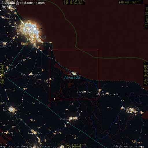
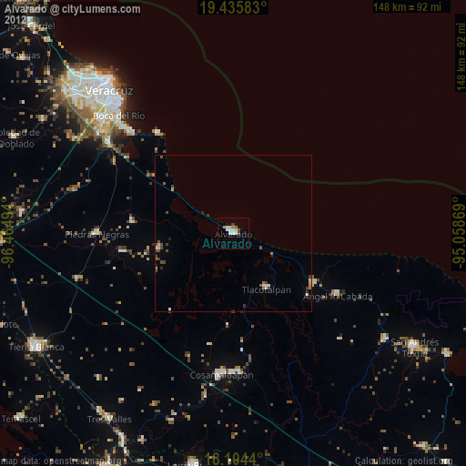
Analysis of Alvarado night lights 2016
Square area 10x10 km:
 0.41%
0.41%90-99
1.86%80-89
1.03%70-79
1.45%60-69
1.86%50-59
0.62%40-49
1.45%30-39
1.03%20-29
1.03%10-19
0%0-9
89.26%Square area 50x50 km:
0.02%90-99
0.18%80-89
0.16%70-79
0.11%60-69
0.16%50-59
0.06%40-49
0.22%30-39
0.17%20-29
0.18%10-19
0.07%0-9
98.67%Clear (daylight) street map image can be seen on geolist.org.
Map coordinates:
19° 26' 9" North, 96° 27' 53.8" West
18° 46' 17.1" North, 95° 45' 42.5" West
18° 6' 15.8" North, 95° 3' 31.3" West
Some cities around Alvarado sort by population:
• Cosamaloapan
45.1 km =28 mi,  184°
184°
• La Isla
45.1 km =28 mi,  245°
245°
• Lerdo de Tejada
30 km =18.6 mi,  121°
121°
• Carlos A. Carrillo
44.1 km =27.4 mi, 178°
• Ángel R. Cabada
38.6 km =24 mi, 120°
• Piedras Negras
43.2 km =26.8 mi,  269°
269°
• Tlacotalpan
20.7 km =12.9 mi,  148°
148°
• Antón Lizardo
40.2 km =25 mi,  322°
322°
3532964 (p: 23,128)
Sources (retrieved 2019-11-25):
» Earth at Night: Flat Maps 2012, 2016