Acatzingo night lights from space
Night Light of Acatzingo (Puebla) from space (Mexico) Src. Average luminocity for 10x10km area is 42.1039% and for 50x50km: 22.3408%.
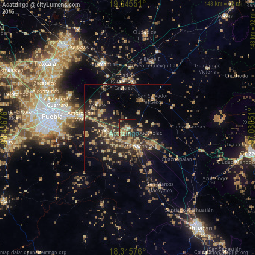
Analysis of Acatzingo night lights 2016
Square area 10x10 km:
 0.43%
0.43%90-99
2.16%80-89
8.23%70-79
11.26%60-69
12.12%50-59
1.73%40-49
8.66%30-39
8.87%20-29
18.4%10-19
26.19%0-9
1.95%Square area 50x50 km:
0.19%90-99
0.73%80-89
4.71%70-79
3.52%60-69
4.63%50-59
2.21%40-49
5.69%30-39
6.26%20-29
8.8%10-19
15.82%0-9
47.45%Clear (daylight) street map image can be seen on geolist.org.
Map coordinates:
19° 38' 43.8" North, 98° 29' 12.3" West
18° 58' 55.1" North, 97° 47' 1.1" West
18° 18' 56.7" North, 97° 4' 49.8" West
Some cities around Acatzingo sort by population:
• Los Reyes de Juárez
4.2 km =2.6 mi,  210°
210°
• Huixcolotla
6.9 km =4.3 mi,  169°
169°
• Tlaixpan
9.1 km =5.7 mi,  148°
148°
• San Hipólito
10.5 km =6.5 mi,  244°
244°
• Actipan de Morelos
2.9 km =1.8 mi, 213°
• Cuapiaxtla de Madero
8.5 km =5.3 mi, 209°
• San Sebastián Villanueva
11.1 km =6.9 mi,  37°
37°
• San Martín Caltenco
11.4 km =7.1 mi,  198°
198°
3533433 (p: 25,811)
Sources (retrieved 2019-11-25):
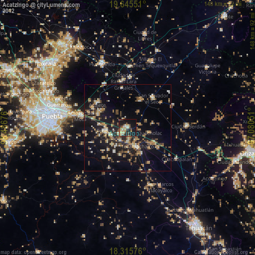
» Earth at Night: Flat Maps 2012, 2016