Mulanje night lights from space
Night Light of Mulanje (Southern Region) from space (Malawi) Src. Average luminocity for 10x10km area is 3.8017% and for 50x50km: 0.3806%.
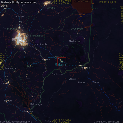
Analysis of Mulanje night lights 2016
Square area 10x10 km:
 0%
0%90-99
0%80-89
0%70-79
0%60-69
0%50-59
2.27%40-49
1.24%30-39
3.31%20-29
1.45%10-19
0%0-9
91.74%Square area 50x50 km:
0%90-99
0%80-89
0%70-79
0.01%60-69
0.08%50-59
0.13%40-49
0.15%30-39
0.21%20-29
0.16%10-19
0.13%0-9
99.12%Clear (daylight) street map image can be seen on geolist.org.
Map coordinates:
15° 21' 17" South, 34° 47' 48.8" East
16° 1' 53.9" South, 35° 30' 0" East
16° 42' 22.5" South, 36° 12' 11.3" East
Some cities around Mulanje sort by population:
• Blantyre
59.3 km =36.8 mi,  297°
297°
• Zomba
74.4 km =46.2 mi,  344°
344°
• Liwonde
111.3 km =69.2 mi, 344°
• Nsanje
102 km =63.4 mi,  194°
194°
• Luchenza
20.5 km =12.7 mi,  277°
277°
• Mwanza
114.7 km =71.3 mi,  294°
294°
• Chikwawa
74.7 km =46.4 mi,  269°
269°
• Thyolo
38.6 km =24 mi,  264°
264°
925789 (p: 16,483)
Sources (retrieved 2019-11-25):
» Earth at Night: Flat Maps 2012, 2016